"THE
GREEN PAGES"
EARTH SCIENCE at SPRING VALLEY HIGH SCHOOL
Sick of green?
QUICK LINKS: INDEX 1 2 3 4 5 6 7 8 9 10
UNIT VI/B: METEOROLOGY – WEATHER MAPS, ENERGY EXCHANGES, FORCASTS
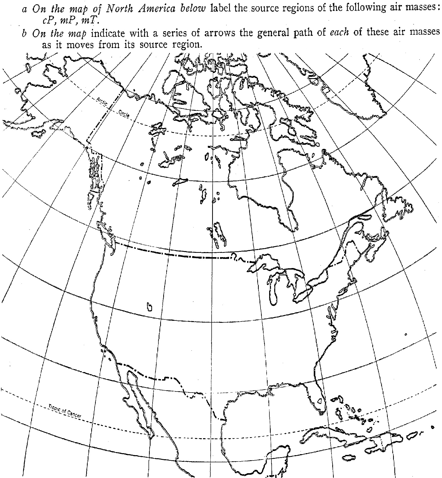
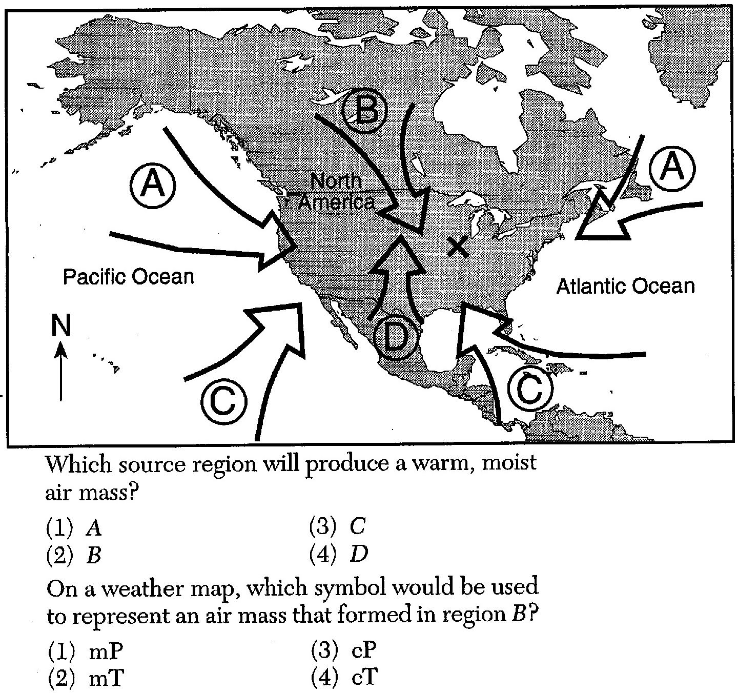
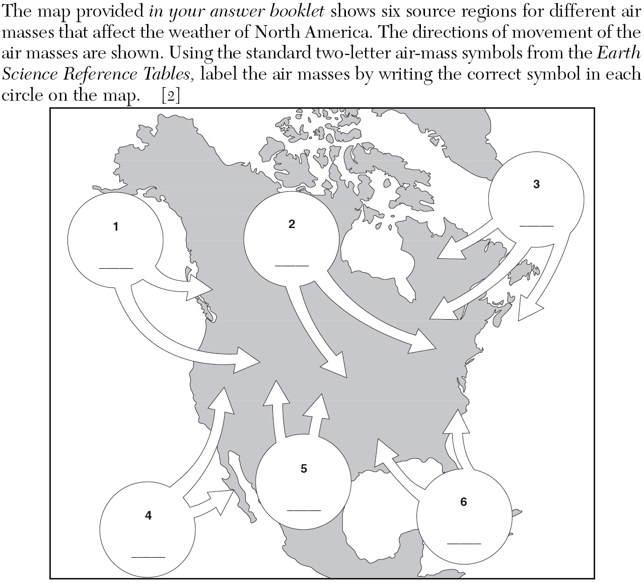
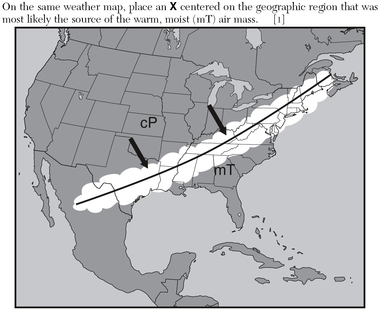
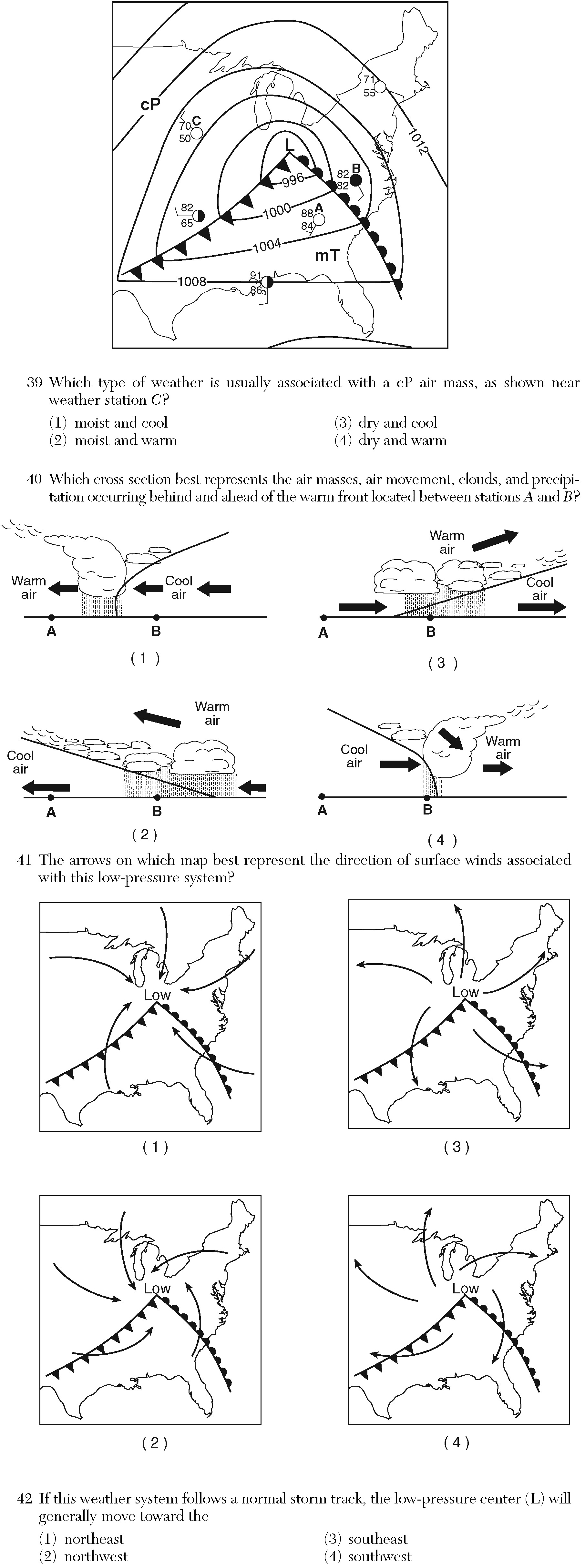
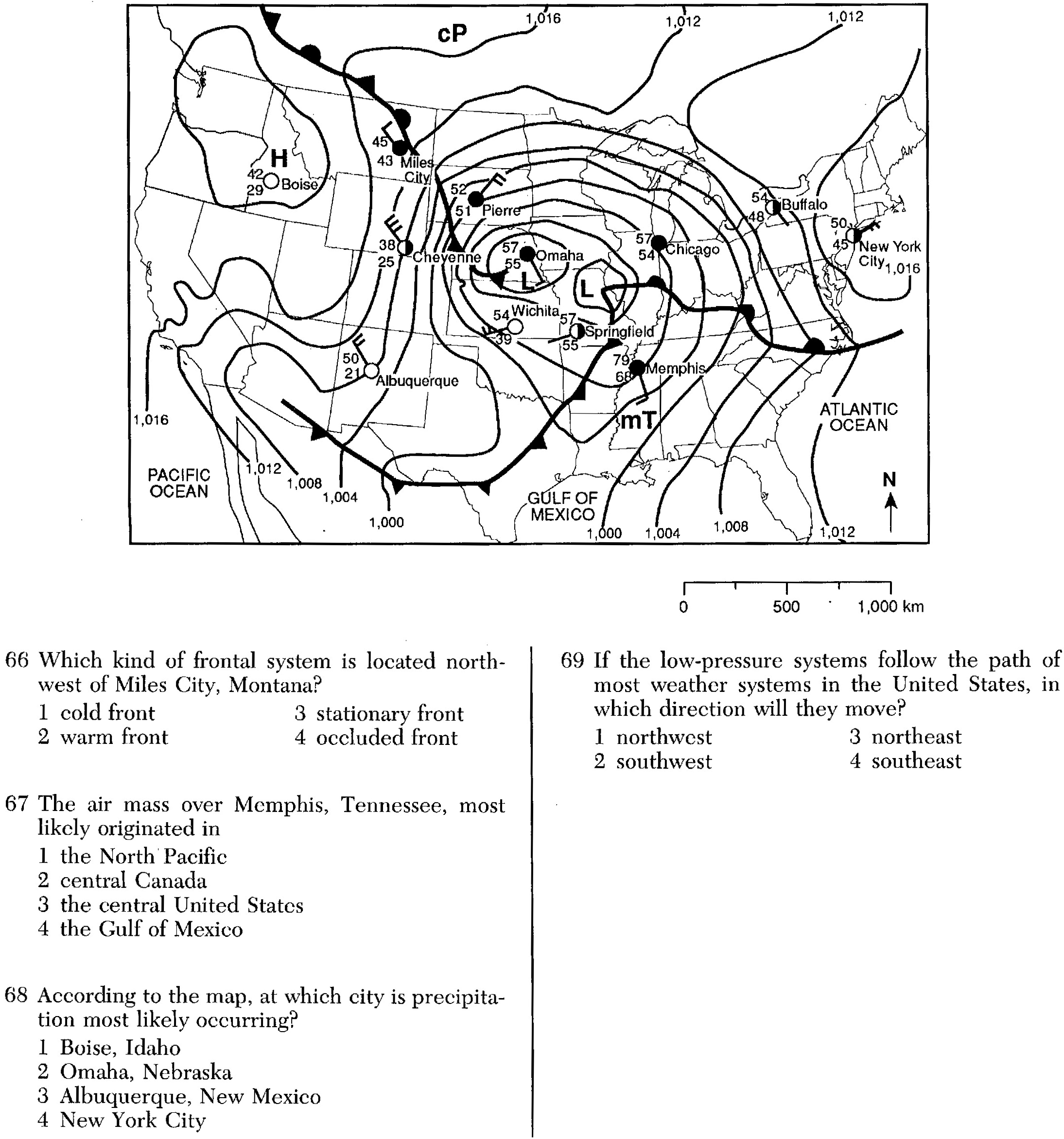
«1. Explain how source regions influence air mass characteristics.
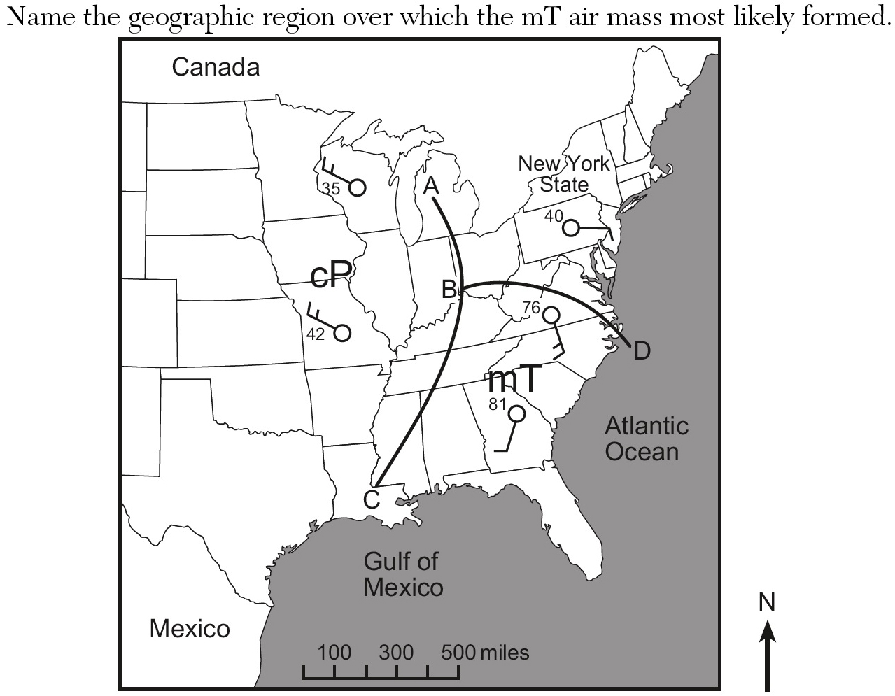
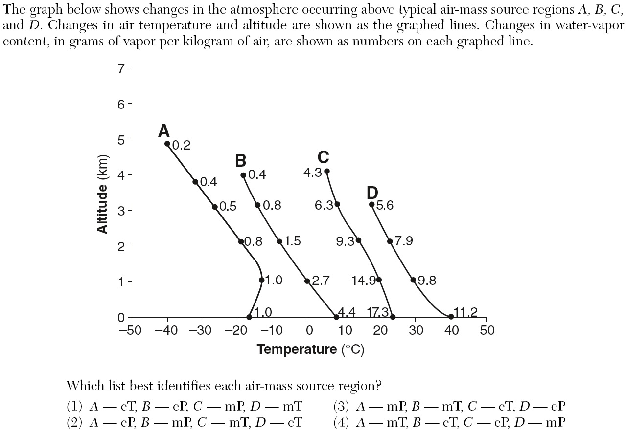
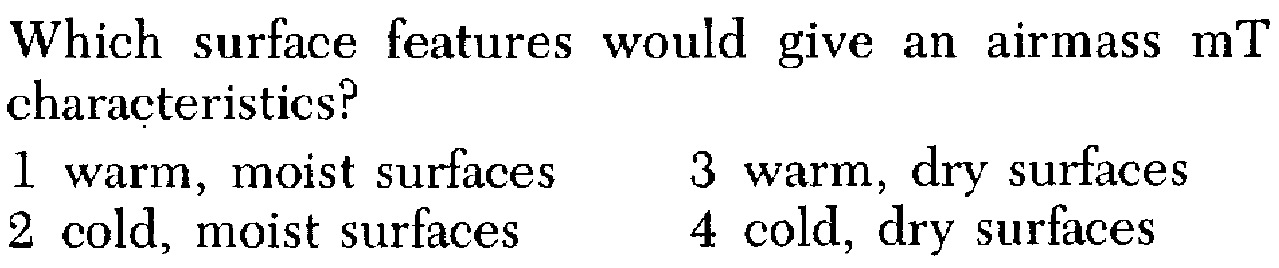
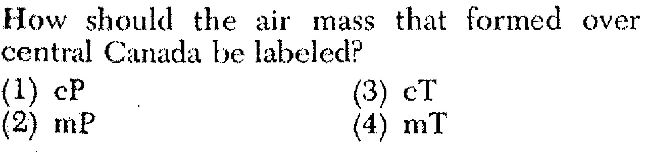
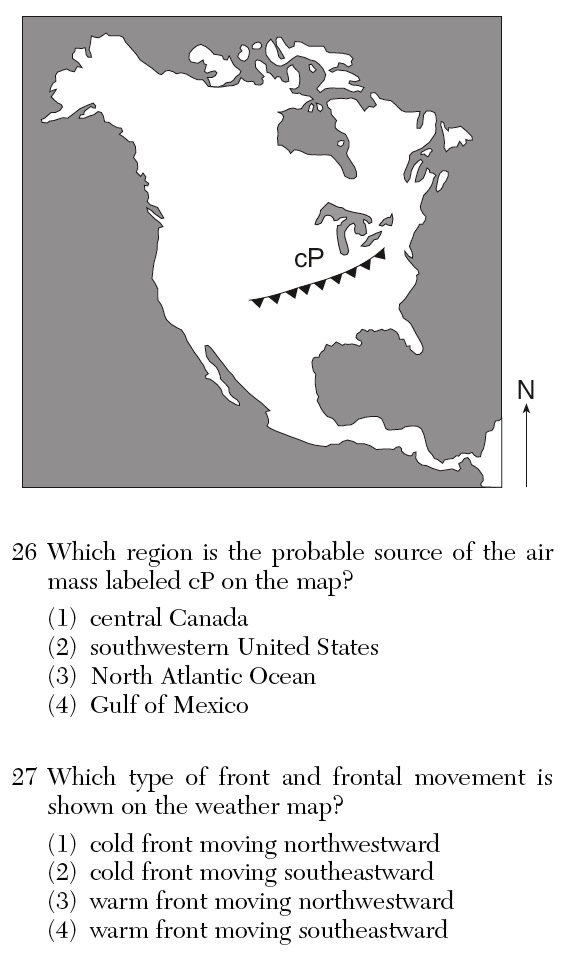
a. An air is a large body of air, usually 1600 kilometers (1000 miles) or more across, which is characterized by a sameness of temperature and moisture at any given altitude.
b. When this air moves out of its region of origin, called the , it will carry these temperatures and moisture conditions elsewhere, perhaps eventually affecting a large portion of a continent.
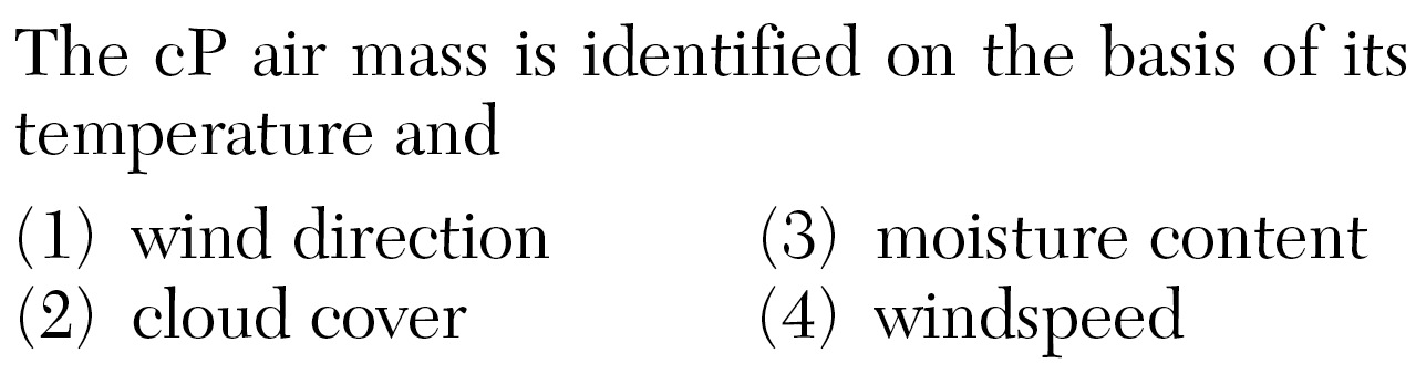
c. Air masses are classified according to:
* 1) the nature of the surface (water or land) in the source region.
* 2) the latitude of the source region.
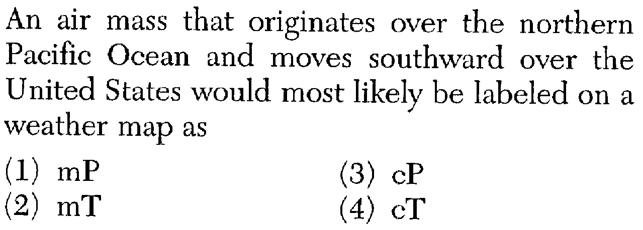
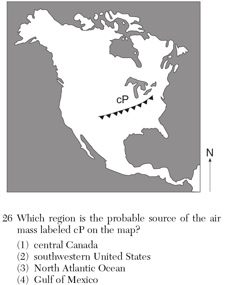
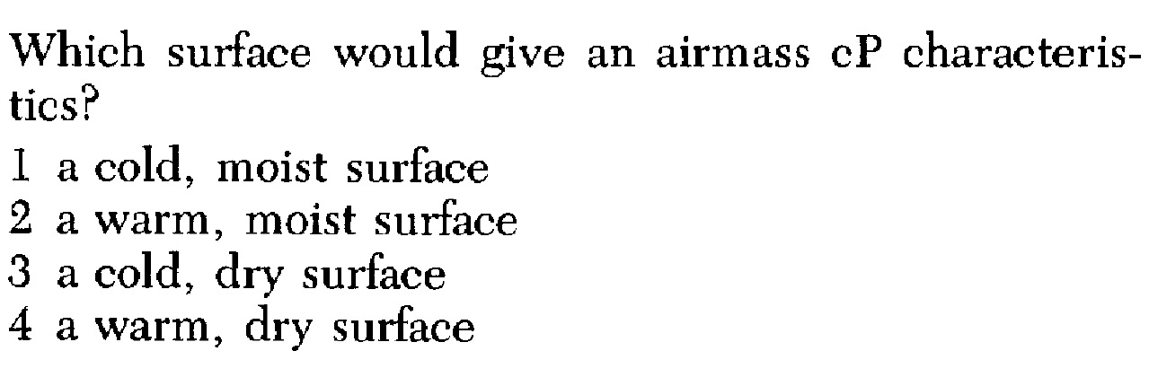
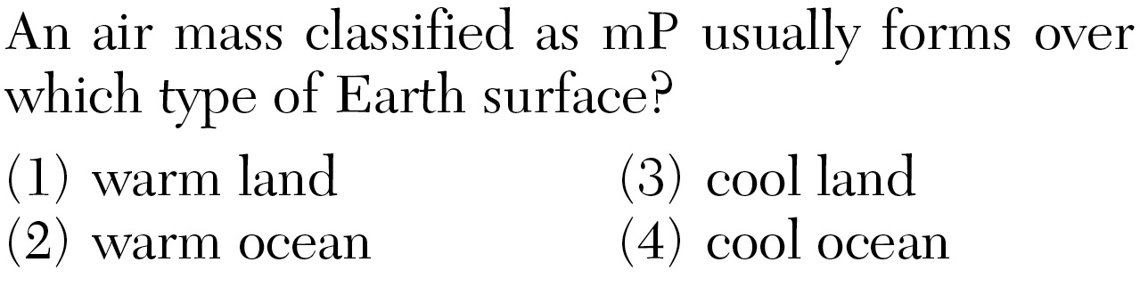
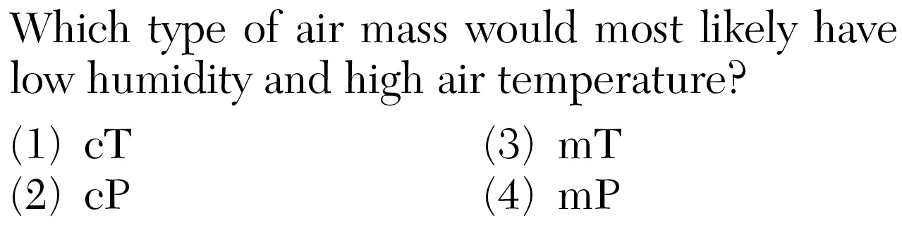
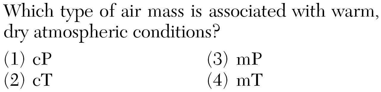
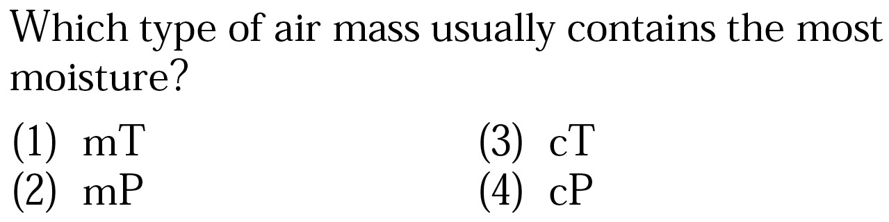
d. (c) designates an air mass of land origin, with the air likely to be dry; whereas a (m) air mass originates over water, and therefore will be relatively humid.
e. (T) air masses form in low latitudes and are warm. (P) air masses originate in high latitudes and are cold. (A) air masses originate in the Polar Regions and are very cold.
f. According to this classification scheme, the five basic types of air masses are continental polar ( ), continental arctic ( ), continental tropical ( ), maritime polar ( ), and maritime tropical ( ).
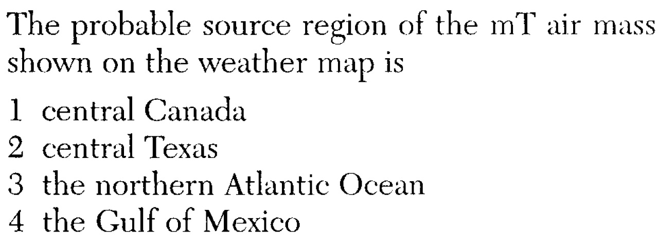
g. Continental polar (cP) air masses from , and maritime tropical (mT) air masses from the of Mexico influence the weather of North America most.
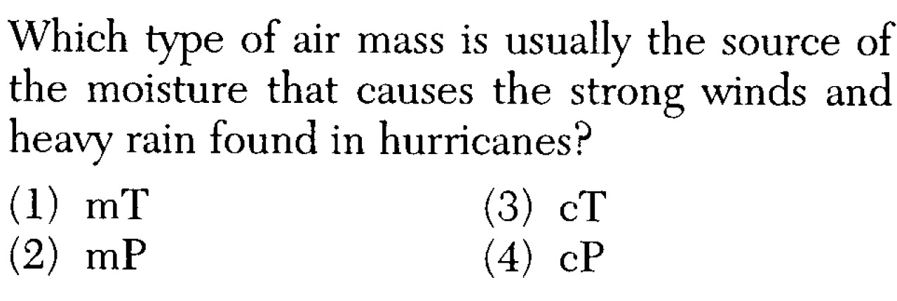
h. tropical air is the source of much, if not most, of the precipitation received in the eastern two-thirds of the United States.
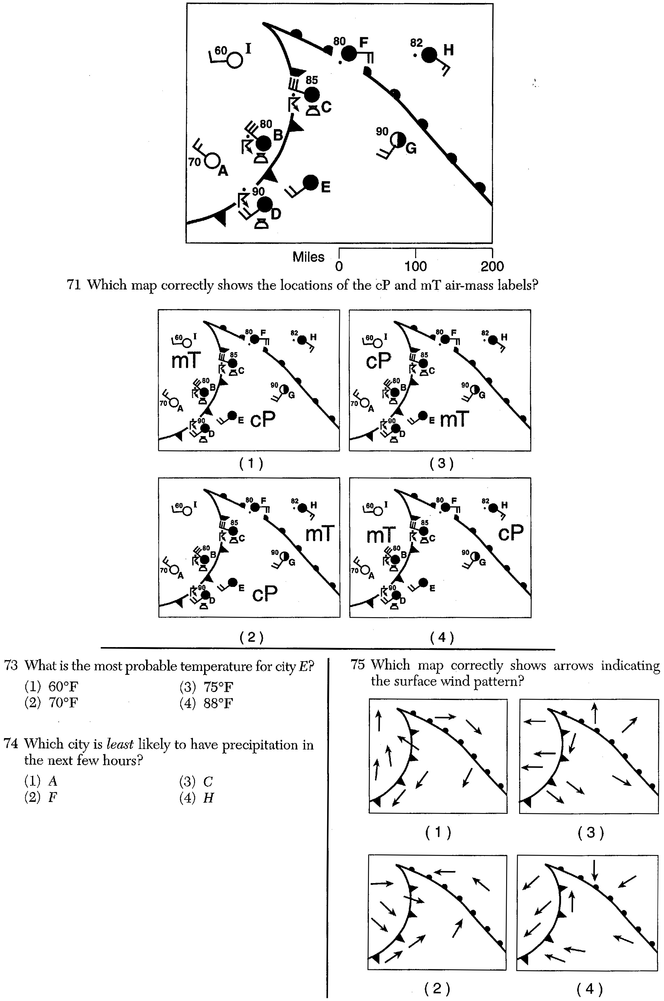
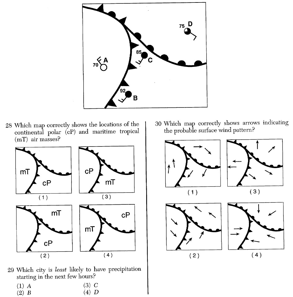
i. You should be able to identify air mass symbols on a weather map (ESRT p.13).
j. and polar air masses usually move southeast over America.
k. air masses usually move northeast over America.
SLIDES (Q1) (Q2) (Q3) (Q4) (Q5) (Q6) (Q7) (Q8) (Q9) (Q10) (Q11) (Q12) (Q13) (Q14) (Q15) (Q16) (Q17) (Q18) (Q19) (Q20) (Q21) (Q22) (Q23) (Q24) (Q25) (Q26) (Q27) (Q28) (Q29) (Q30) (Q31) (Q32) (Q33) (Q34) (Q35)
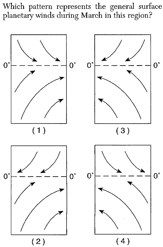
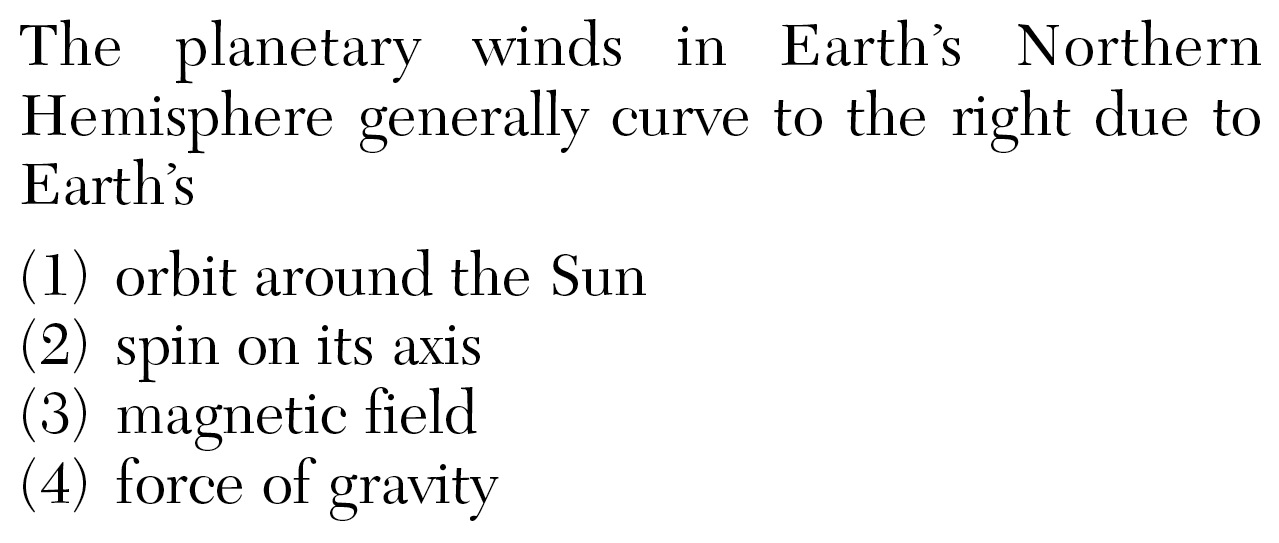
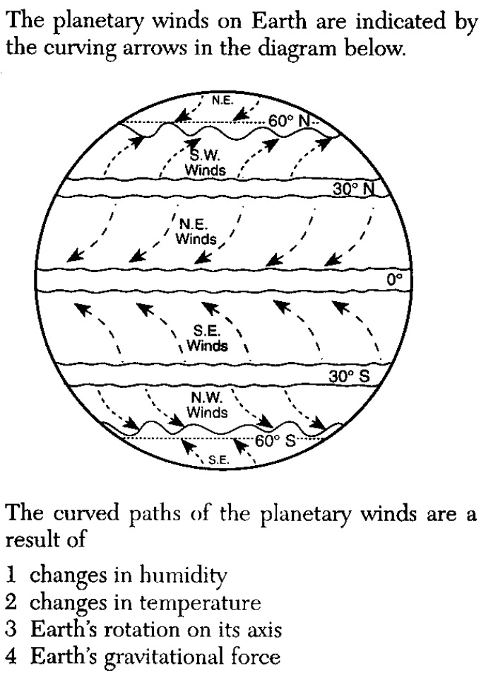
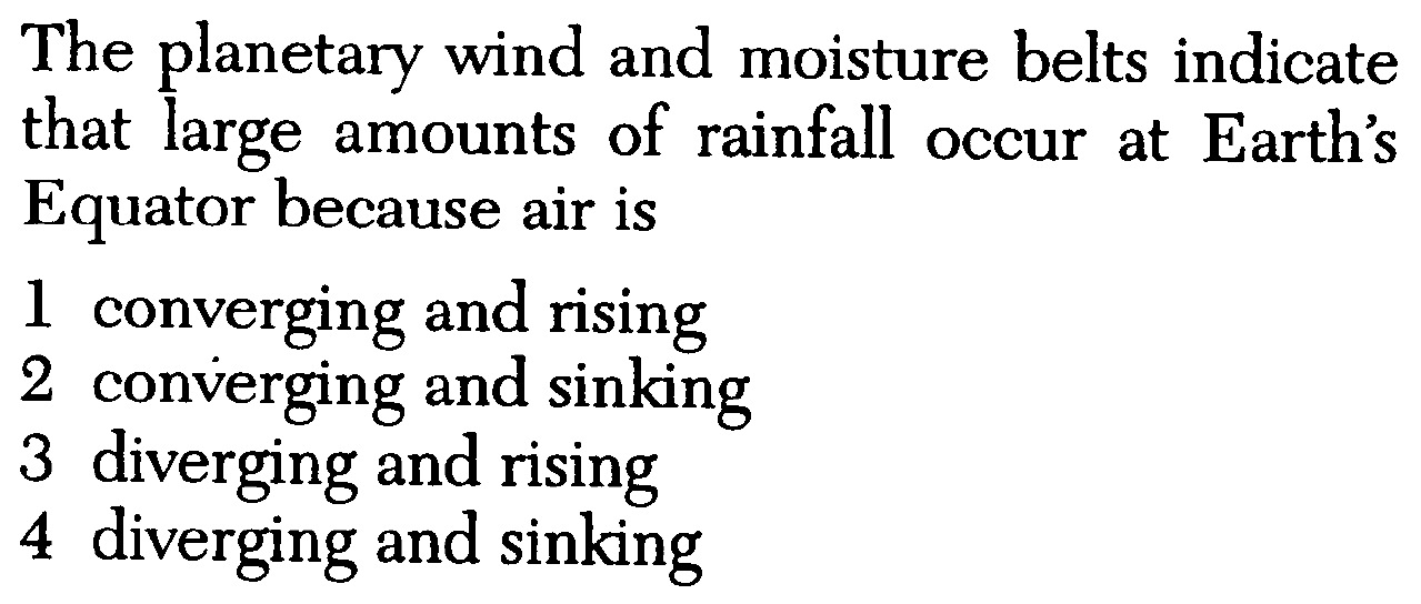
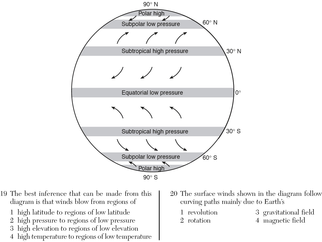
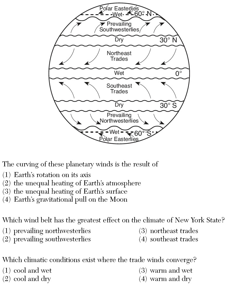
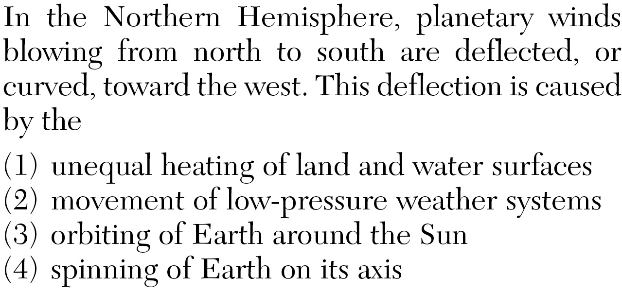
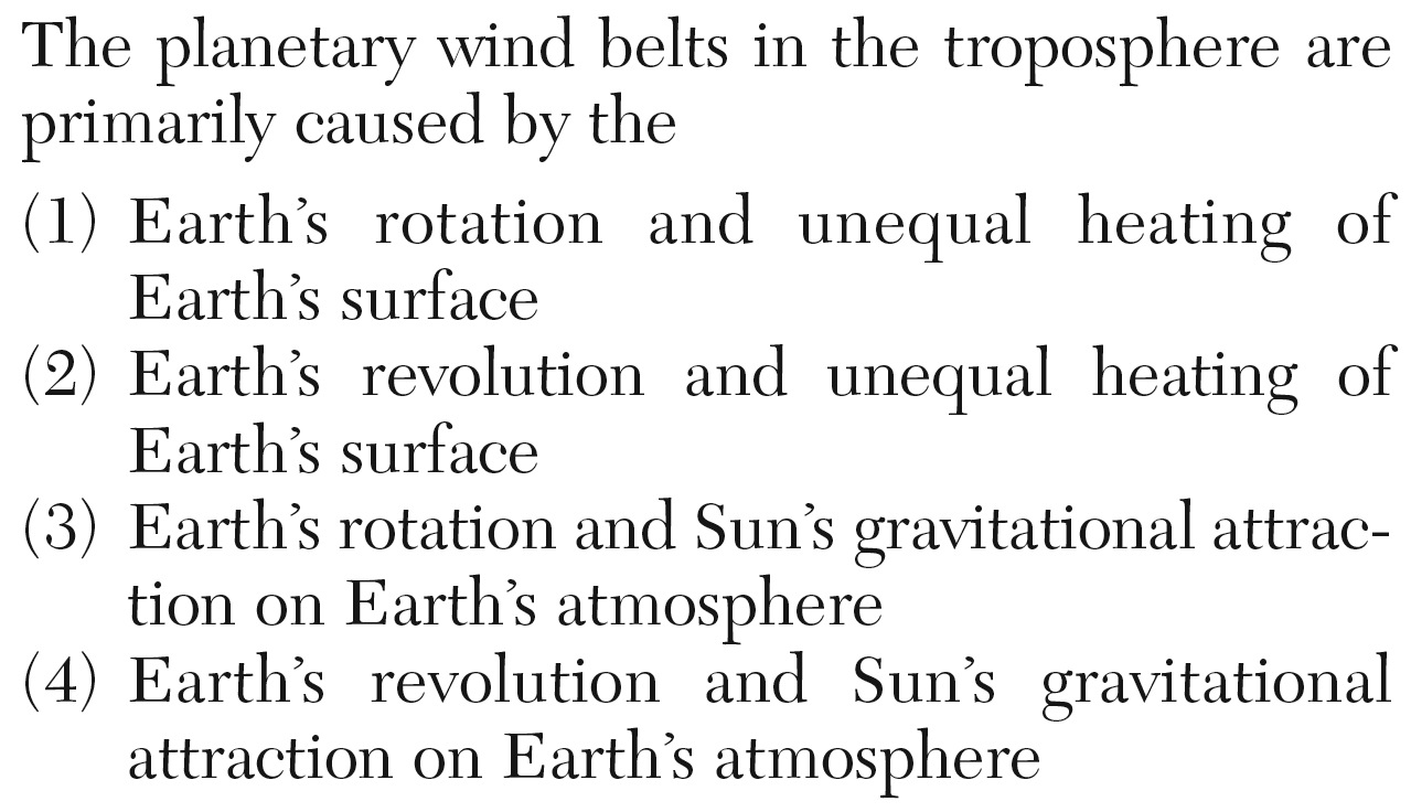
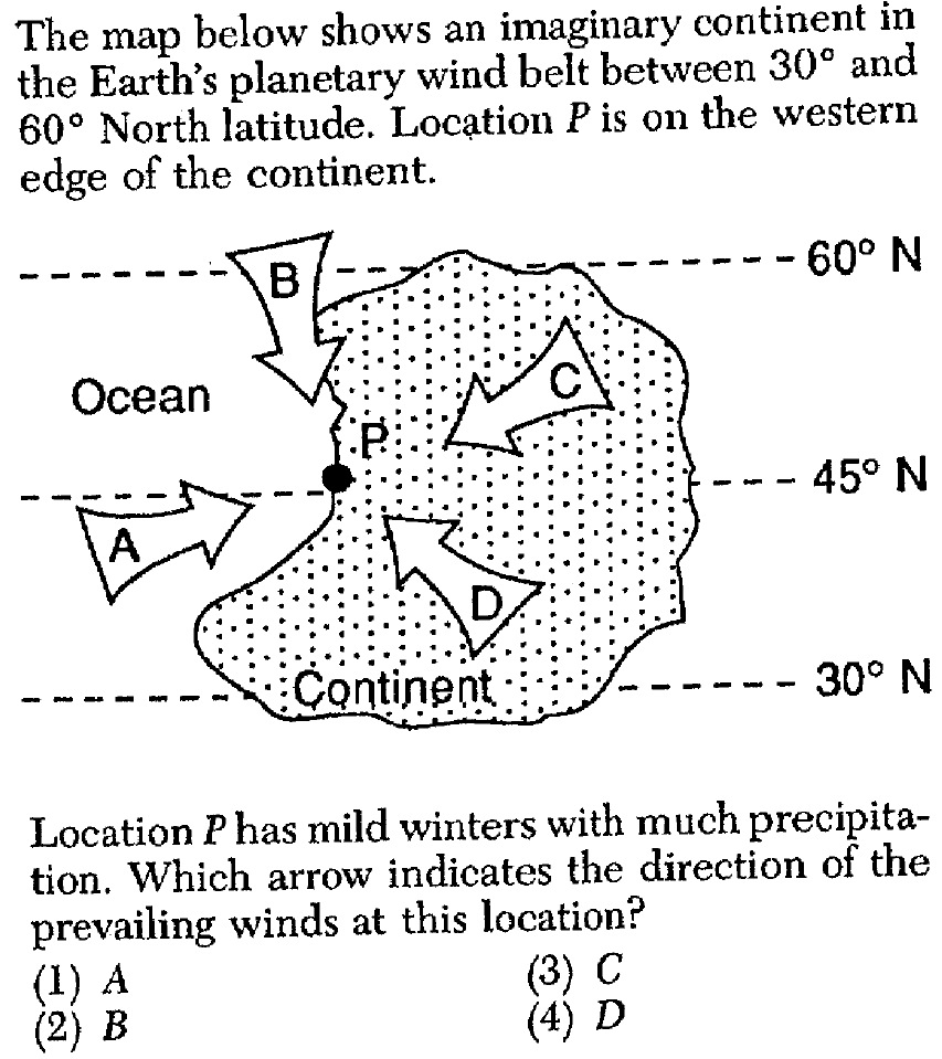
l. Air masses move in the direction of the planetary and jet (ESRT p.14).
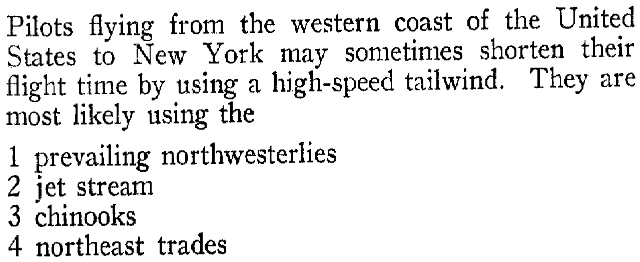
m. Jetstream- An area of strong that are concentrated in a relatively narrow belt in the upper troposphere of the Northern and Southern Hemispheres. Jetstreams flow in a band around the globe from to east. Jetstreams form the dividing lines between tropical air masses and cold air masses, and they steer global weather systems.
SLIDES (Q1) (Q2) (Q3) (Q4) (Q5) (Q6) (Q7) (Q8) (Q9) (Q10) (Q11) (Q12) (Q13) (Q14) (Q15) (Q16) (Q17) (Q18)
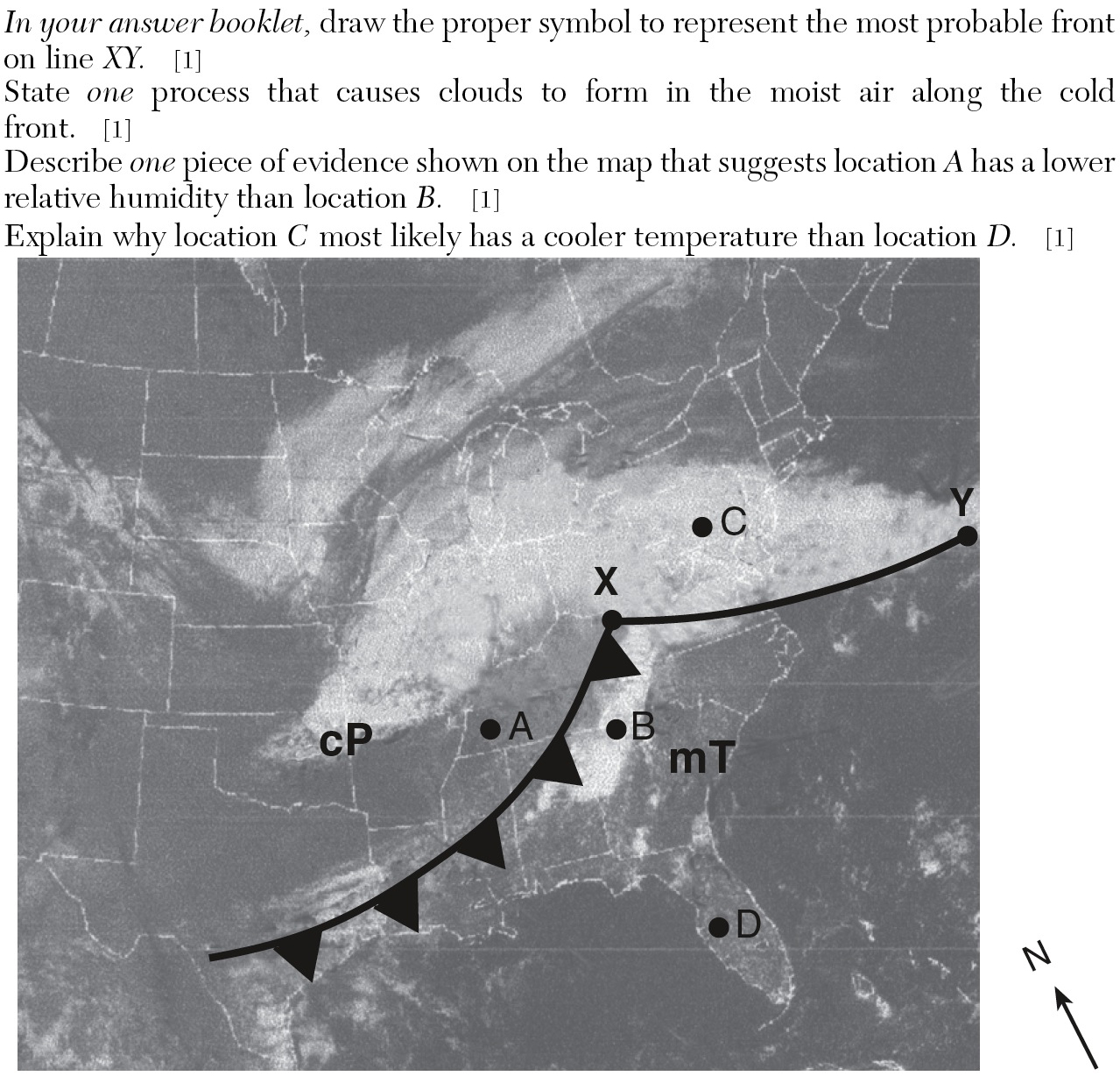
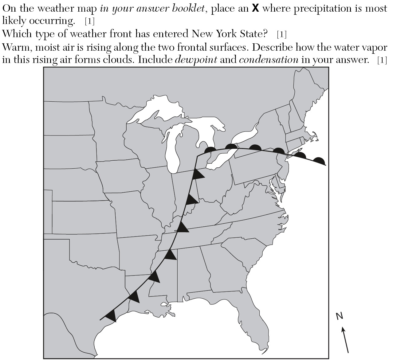
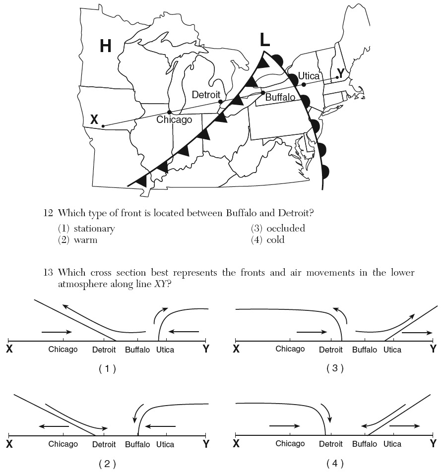
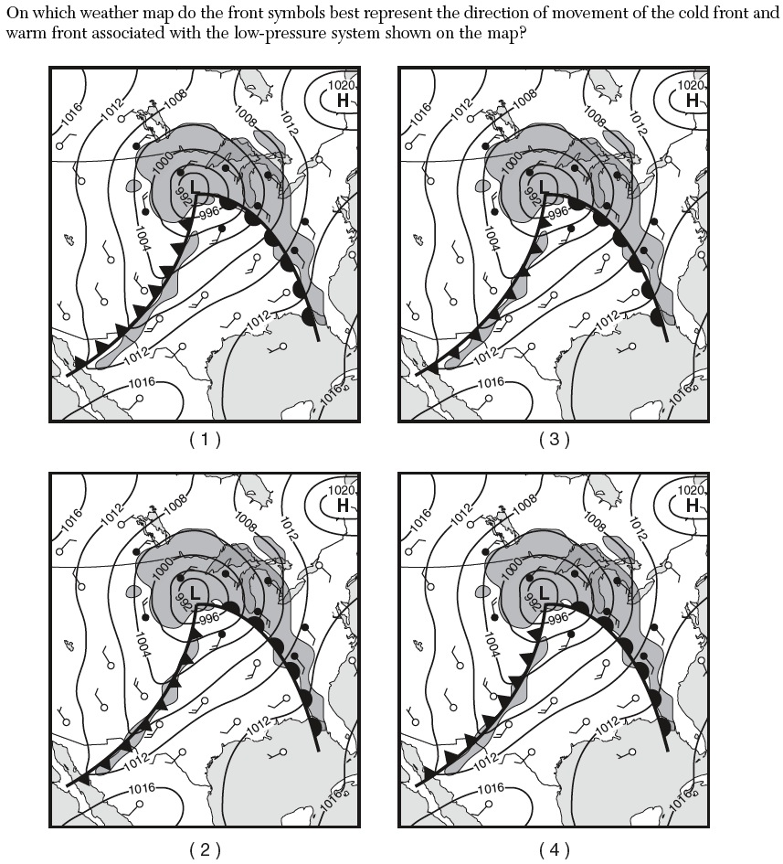
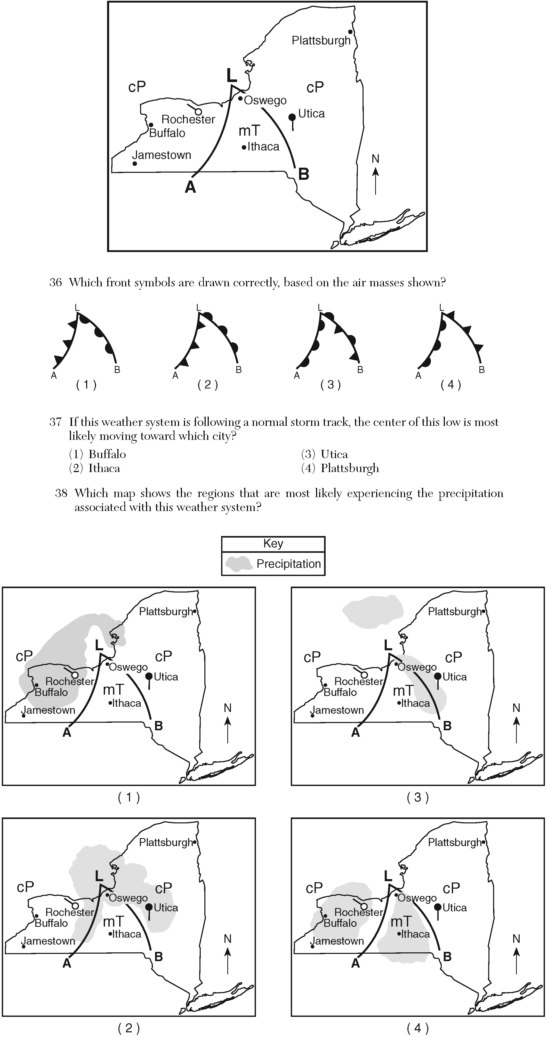
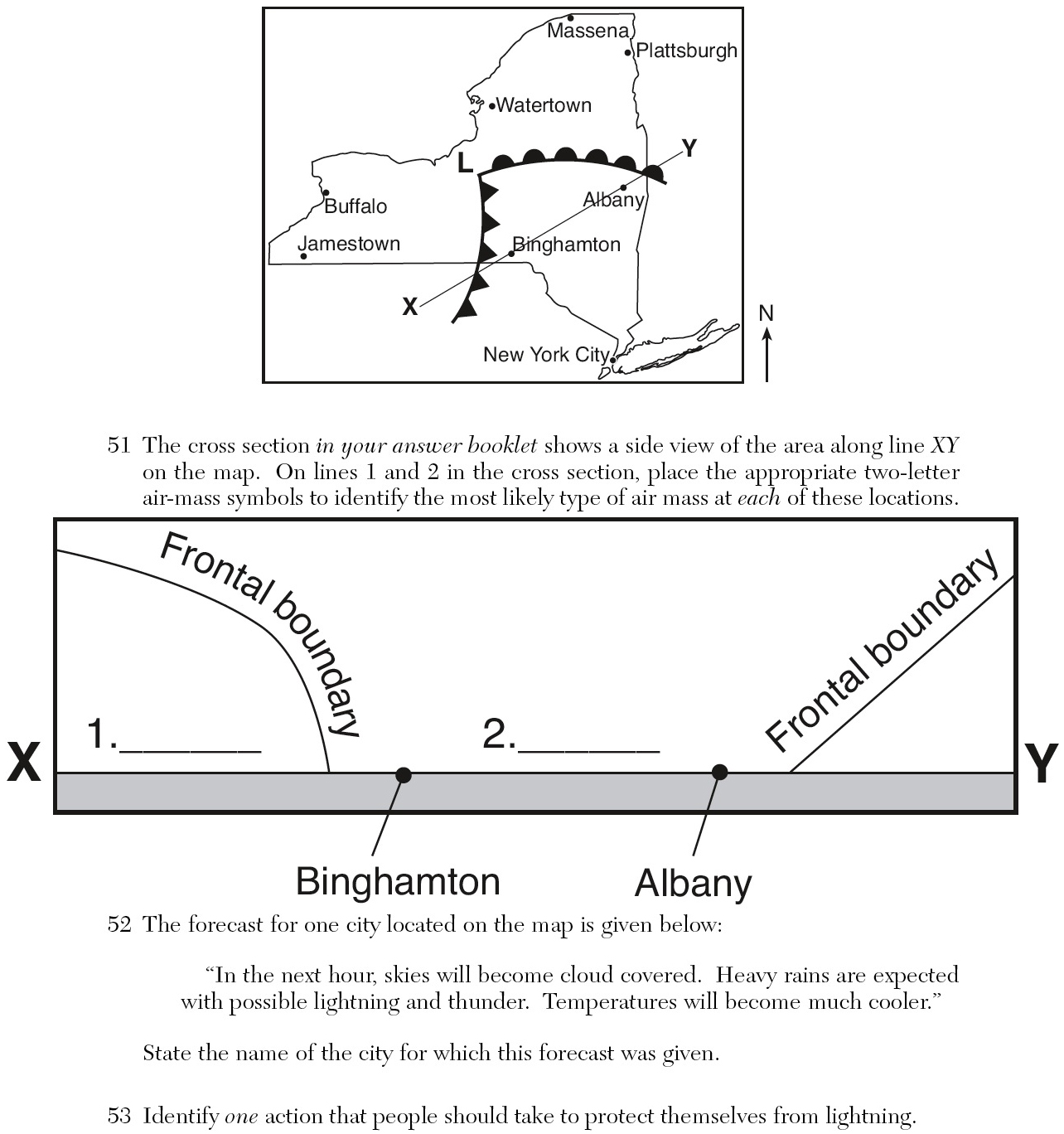
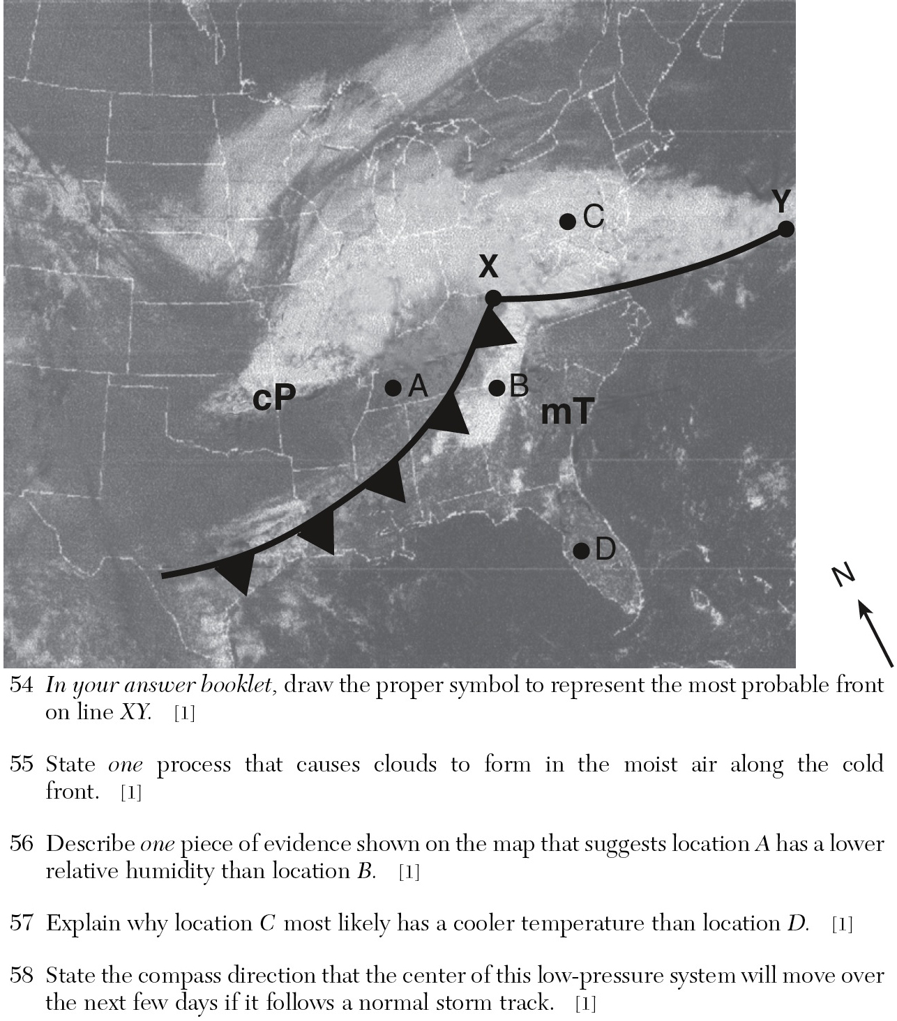
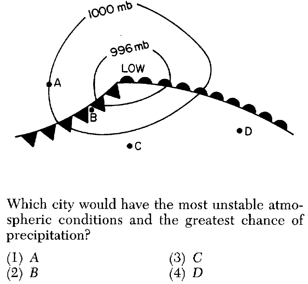
«2. Understand that fronts form where air masses meet.
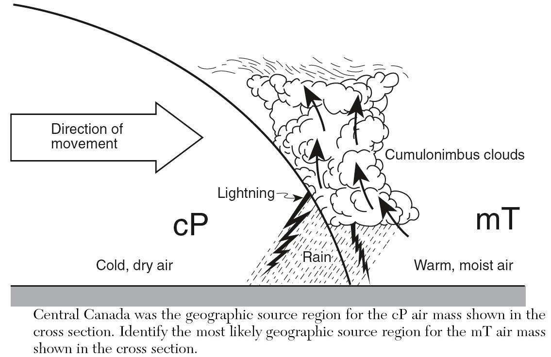
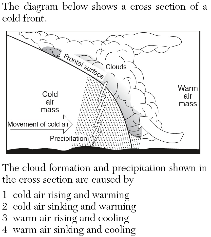
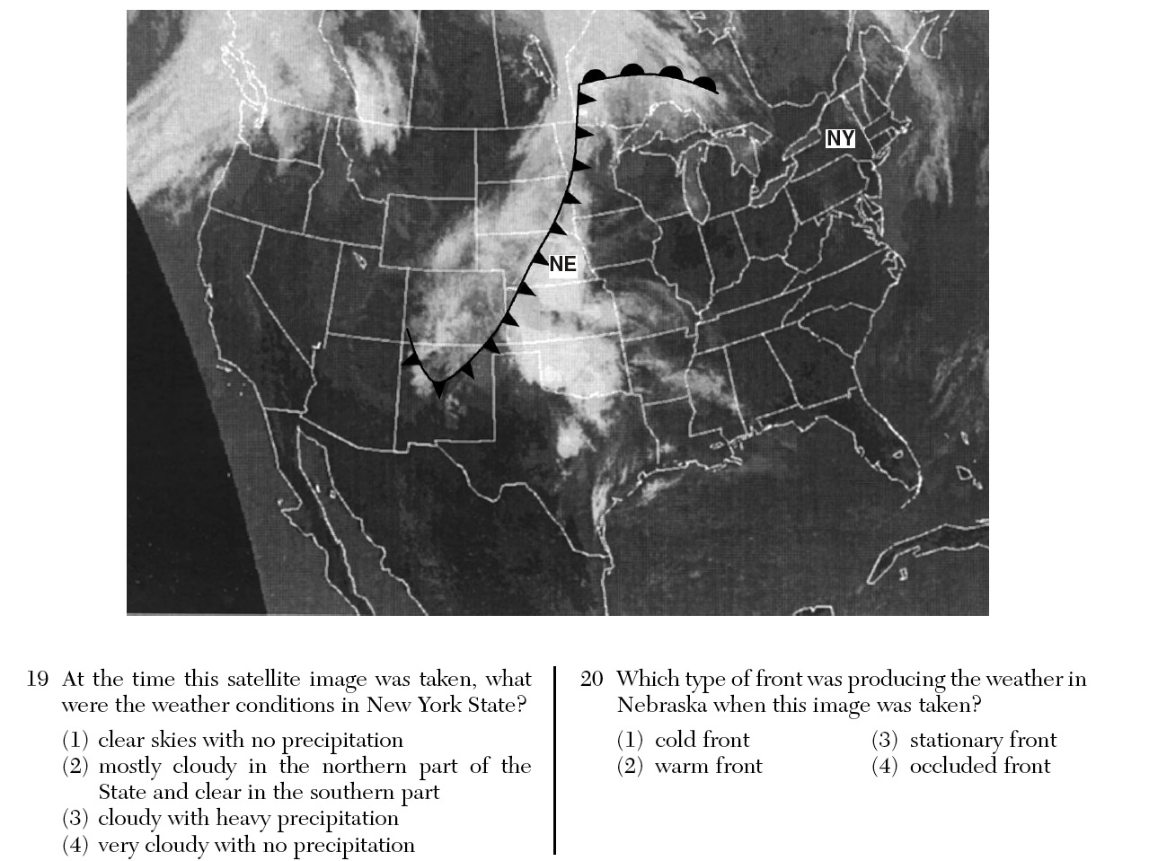
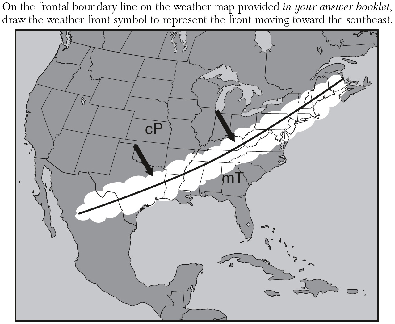
a. - the leading edge of an advancing air mass.
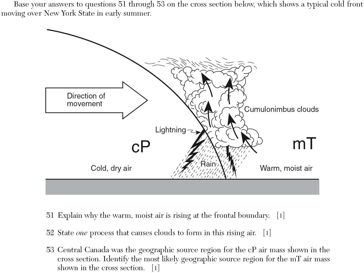
b. When a cold air mass (cP, cA, or mP) moves towards a warm air mass (mT or cT), the air mass is forced to rise.
c. When a warm air mass moves towards a cold air mass, the air mass is forced to rise up and over the air mass.
d. Cold air is , so the warm air mass is always the one forced up and over colder air.
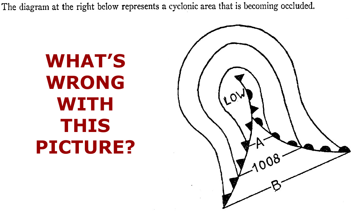
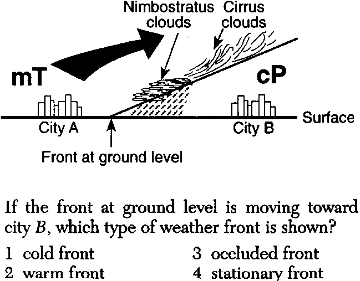
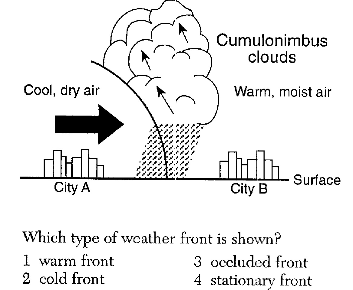
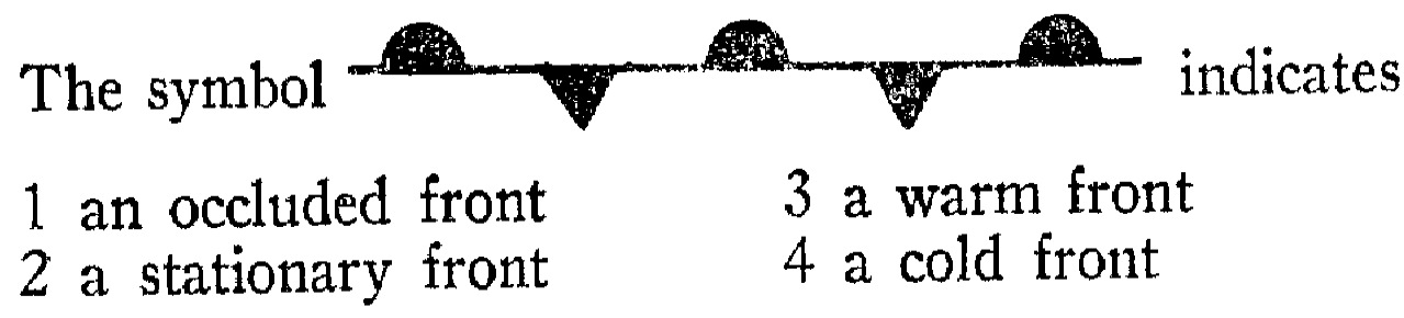
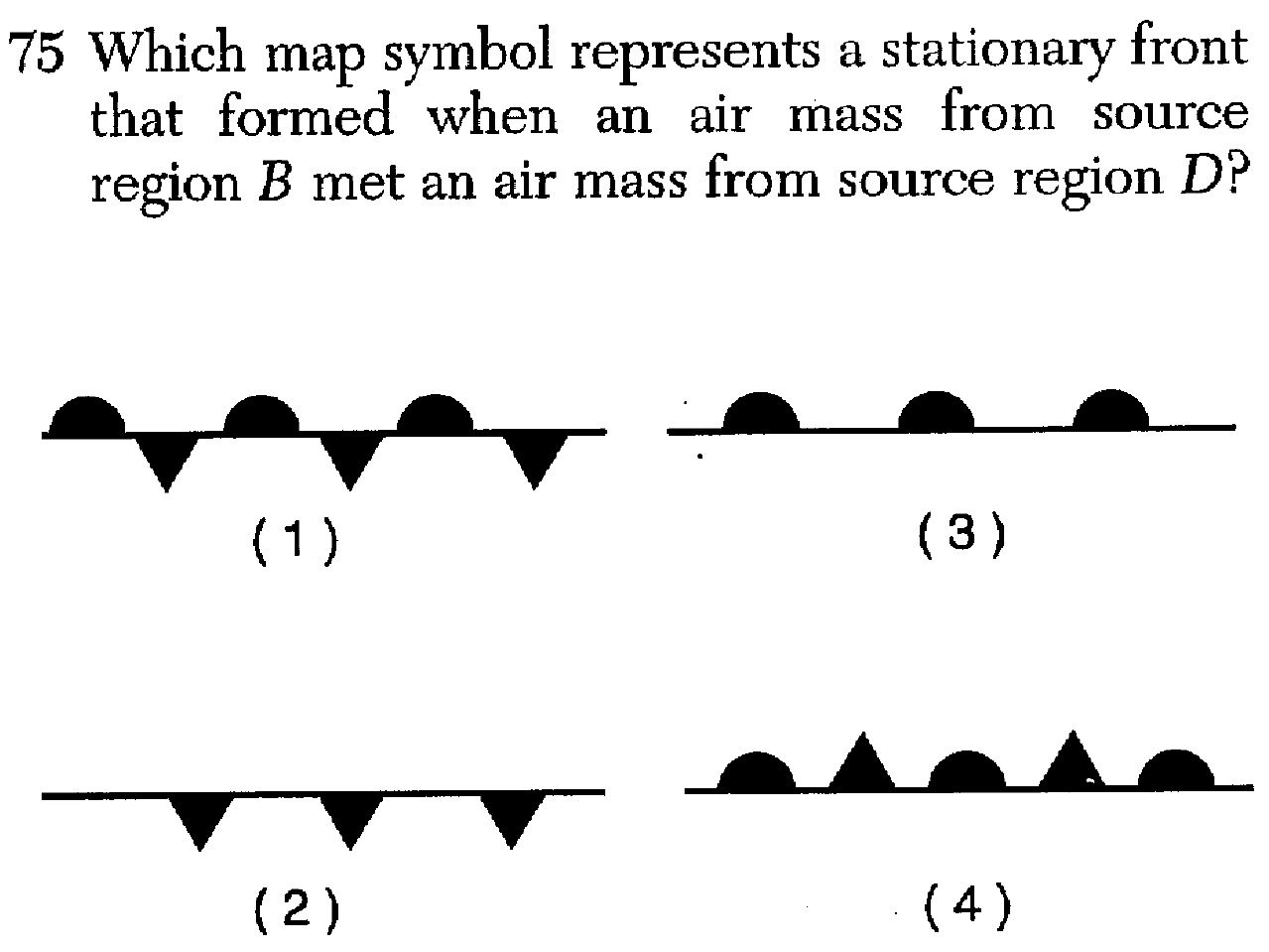
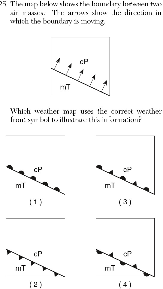
«3. Compare and contrast the characteristics of cold, warm, stationary and occluded
fronts (ESRT p.13).
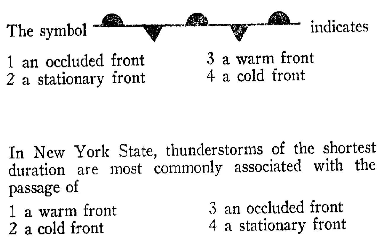
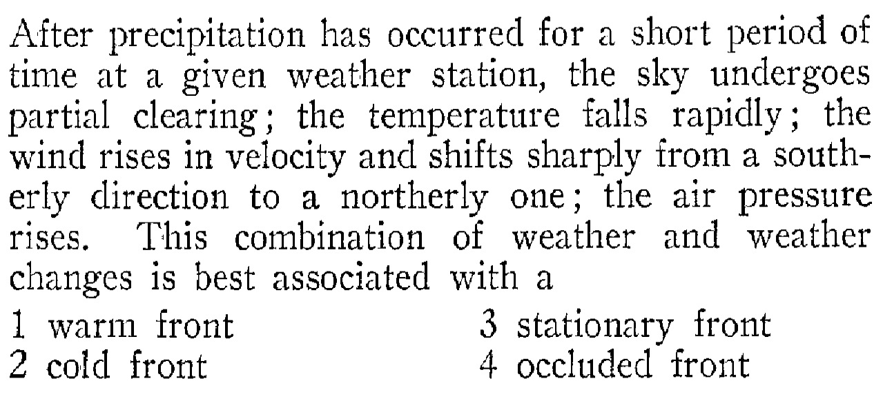
a. front- The leading edge of a quickly (averaging 30 mph) advancing cold air mass that is moving under, and displacing, the warmer air in its path. Generally, with the passage of a cold front, the temperature and humidity decrease. Showers, thunderstorms, and sometimes hail generally occur at and/or behind the front.
b. Squall line- a line of sudden, sometimes violent that develop along the leading edge of a cold front, often hundreds of kilometers long.
c. front- the leading edge of a slowly (averaging 15 mph) advancing warm air mass that is rising up and over a retreating relatively colder air mass. Generally, with the passage of a warm front, the temperature and humidity increase. Precipitation, in the form of light rain, snow, or drizzle, is generally found ahead of the front, and may last for one to two days.
d. front- the boundary between two air masses that are not moving (moving less than 6 mph). Also: two air masses are sliding past each other, in parallel paths, and the boundary between them is not moving. May last for several days.
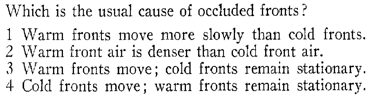
e. front: when a cold front catches up with a warm front. It develops when three different air masses come together: A warm air mass is pinched between a cold and a cool air mass. The air mass is lifted completely off of the ground.
f. Thunderstorms are caused by the upward movement of warm, moist, unstable air, associated with frontal lifting.
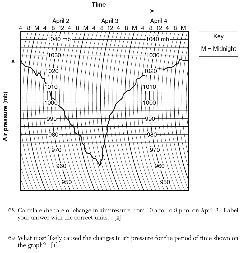
g. Often, with the passage of a front, the pressure will decrease then increase, and there will be a sharp change in the direction.
SLIDES (Q1) (Q2) (Q3) (Q4) (Q5) (Q6) (Q7) (Q8) (Q9) (Q10) (Q11) (Q12) (Q13) (Q14) (Q15) (Q16) (Q17) (Q18) (Q19) (Q20) (Q21) (Q22) (Q23) (Q24) (Q25) (Q26) (Q27)
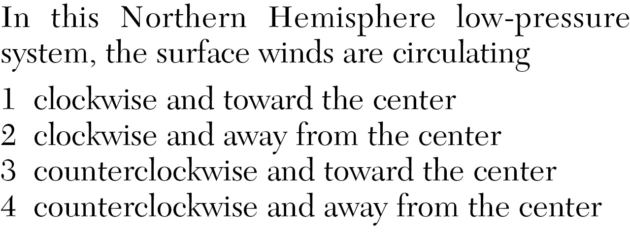
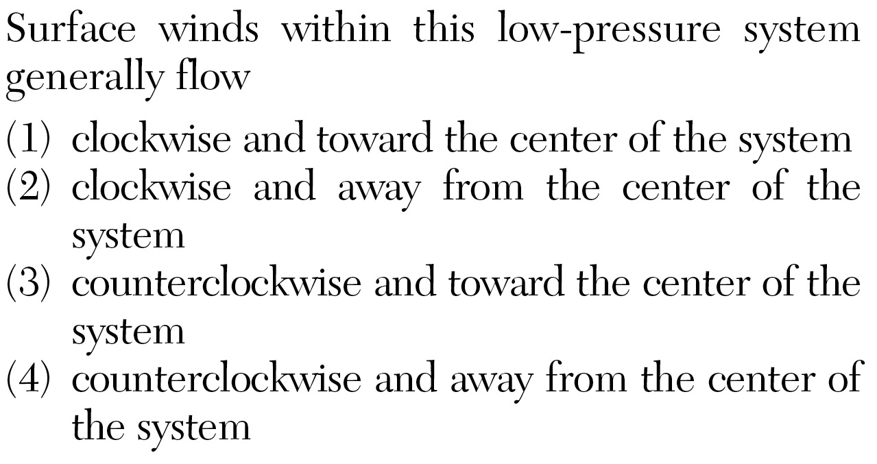
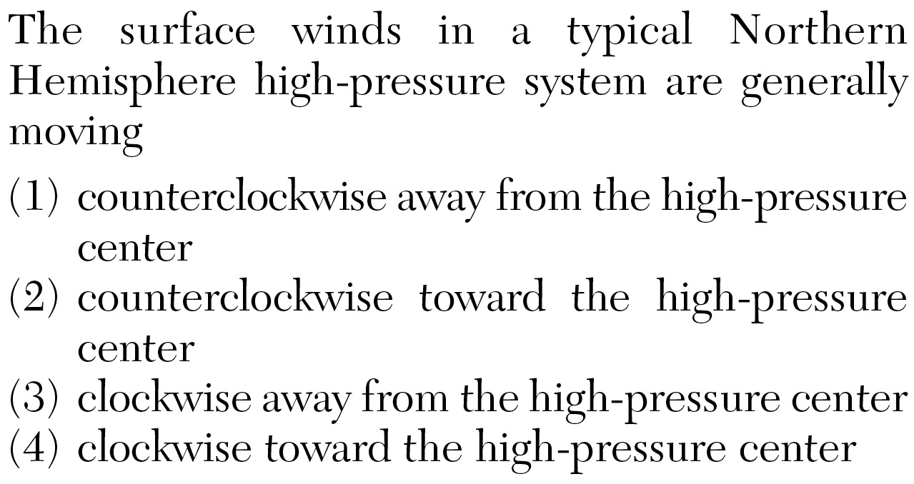
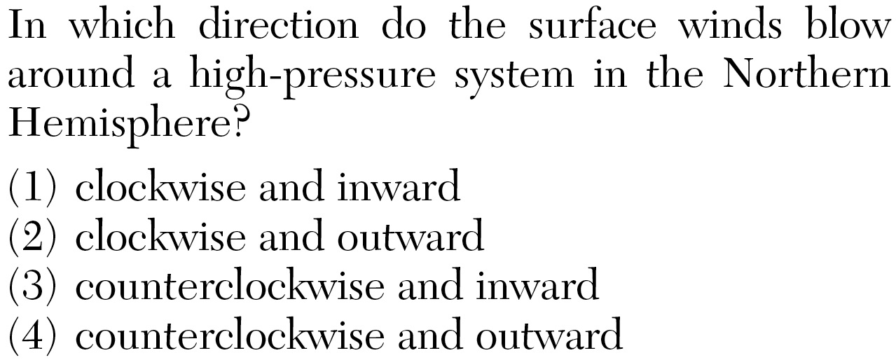
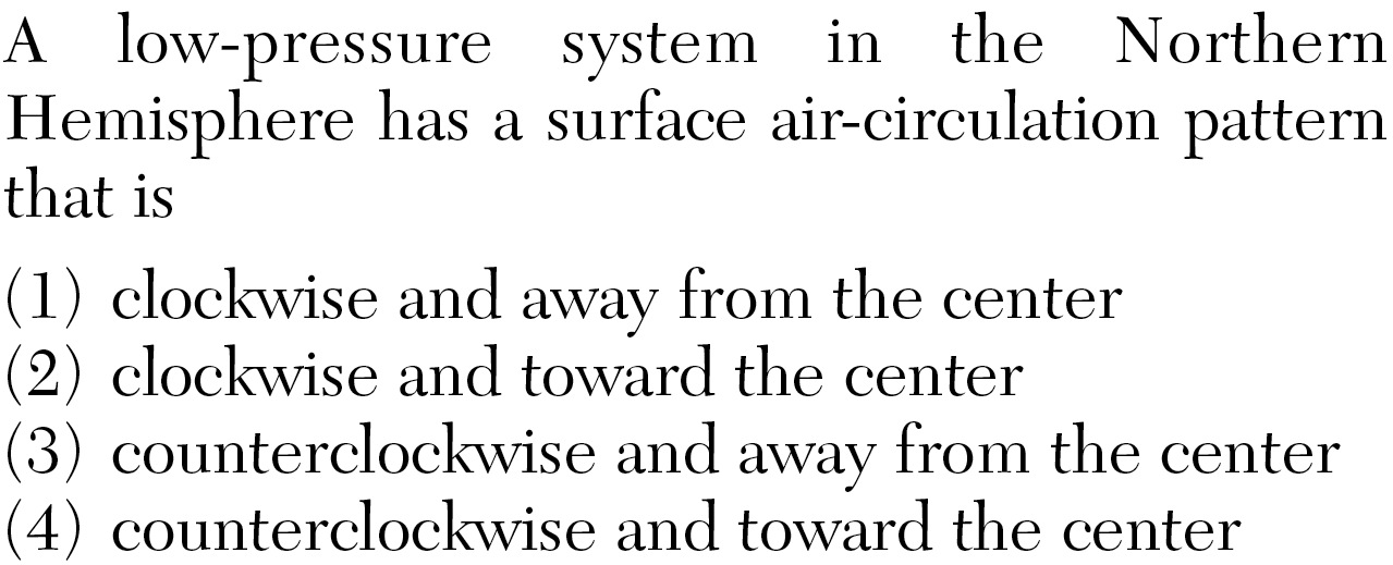
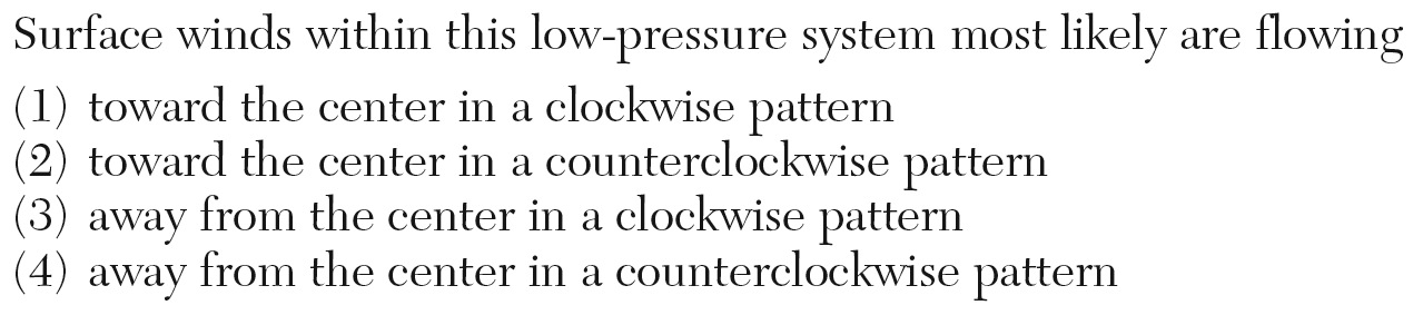
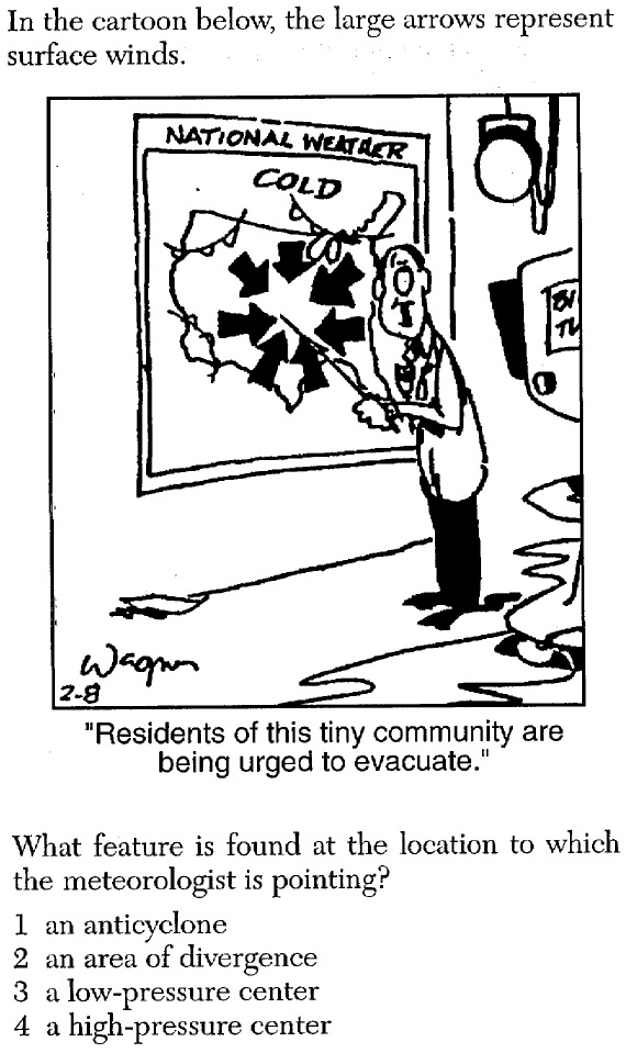
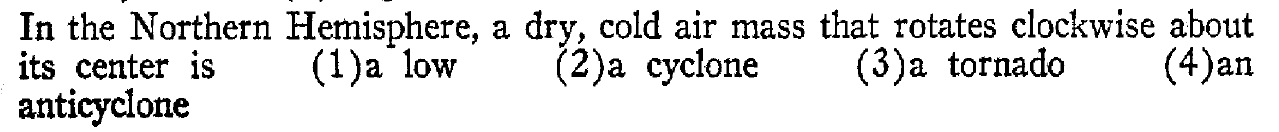
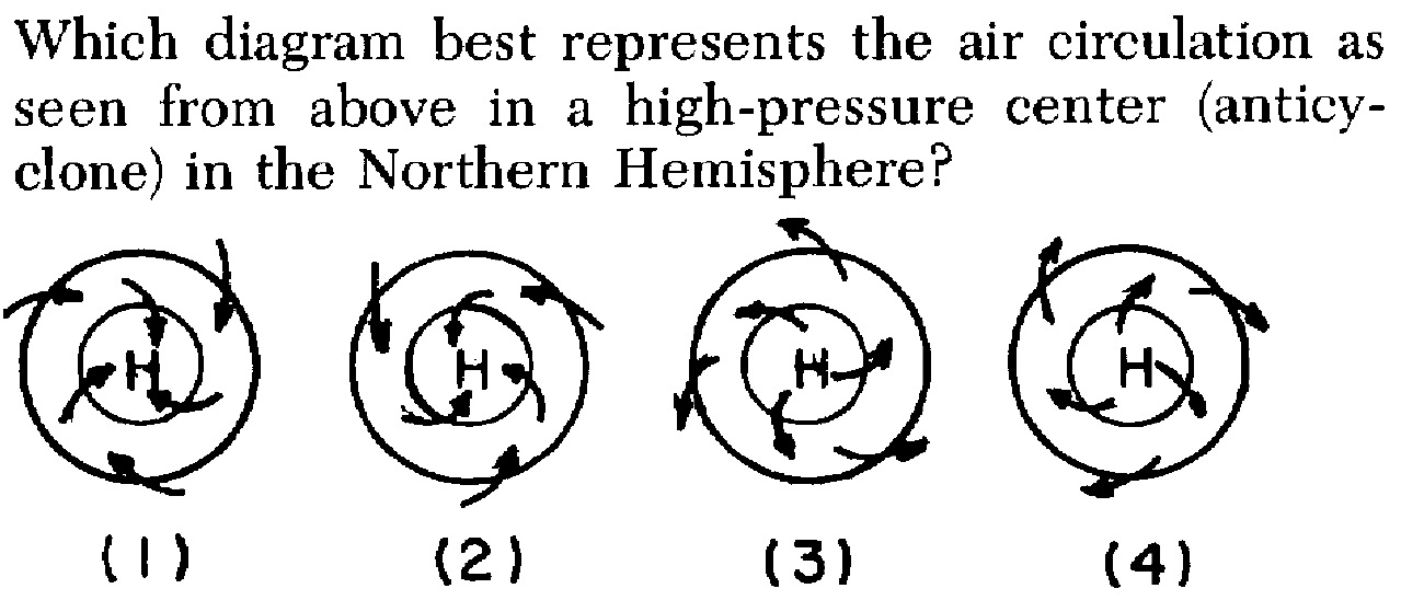
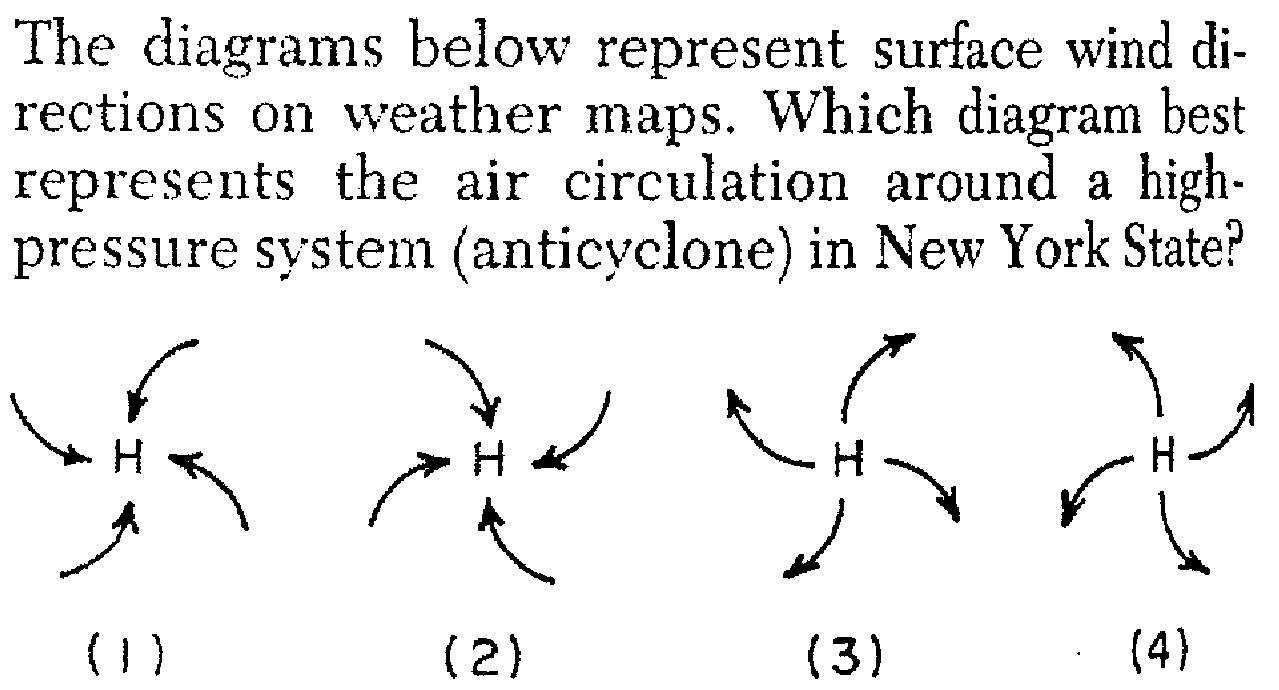
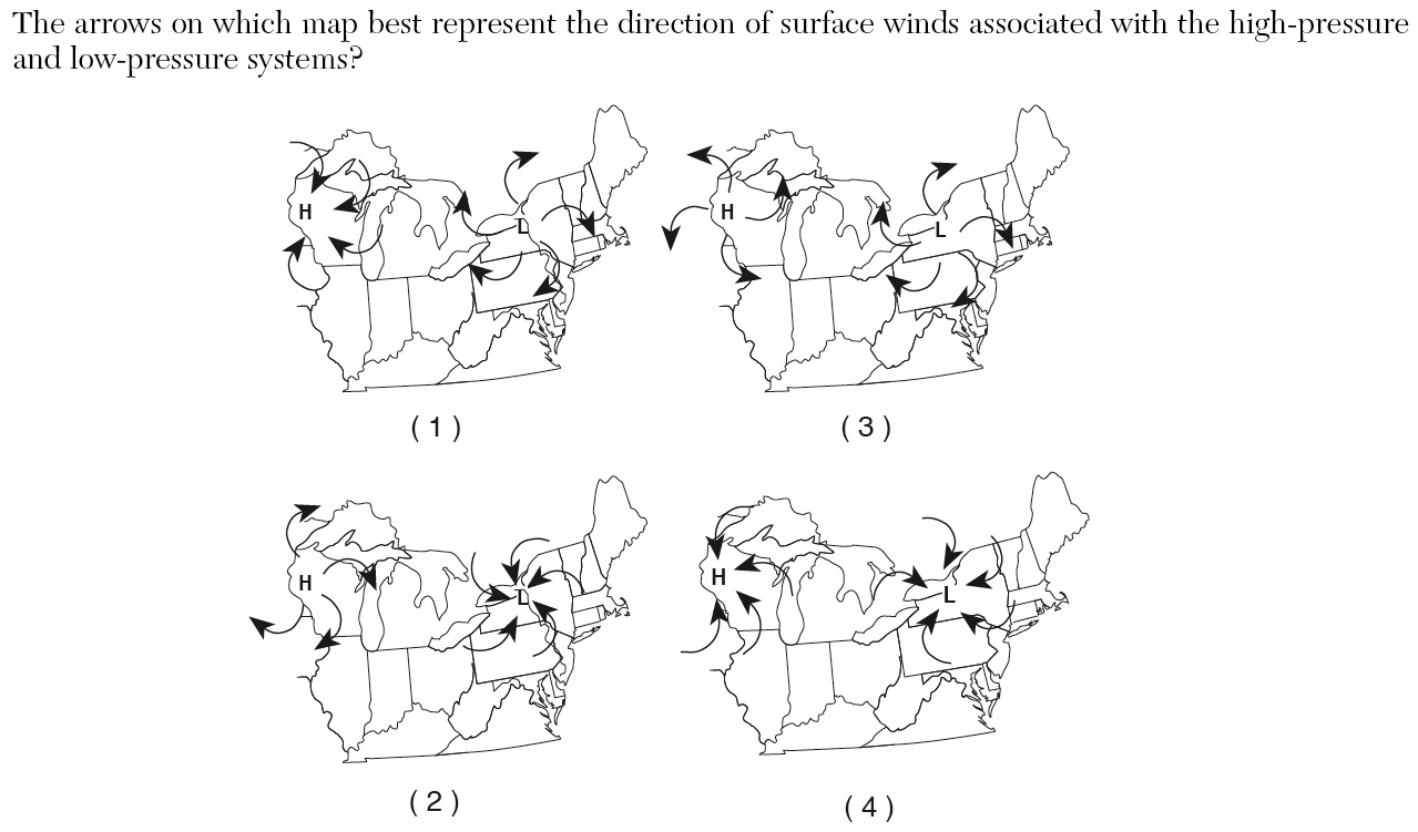
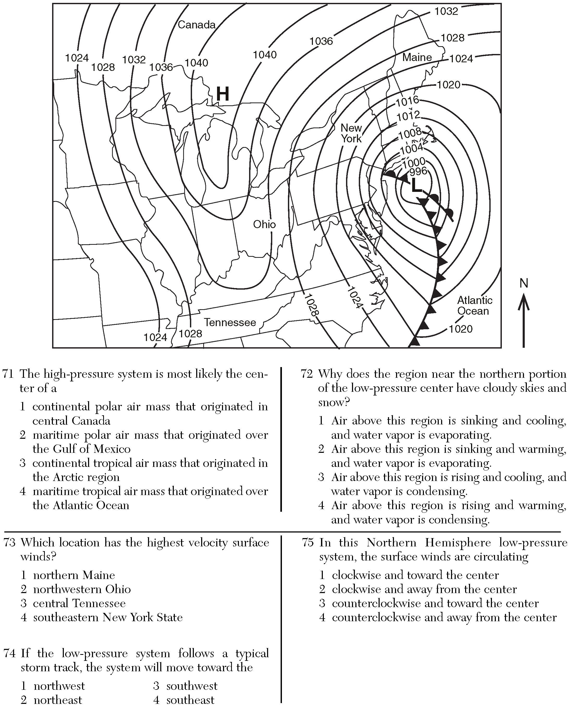
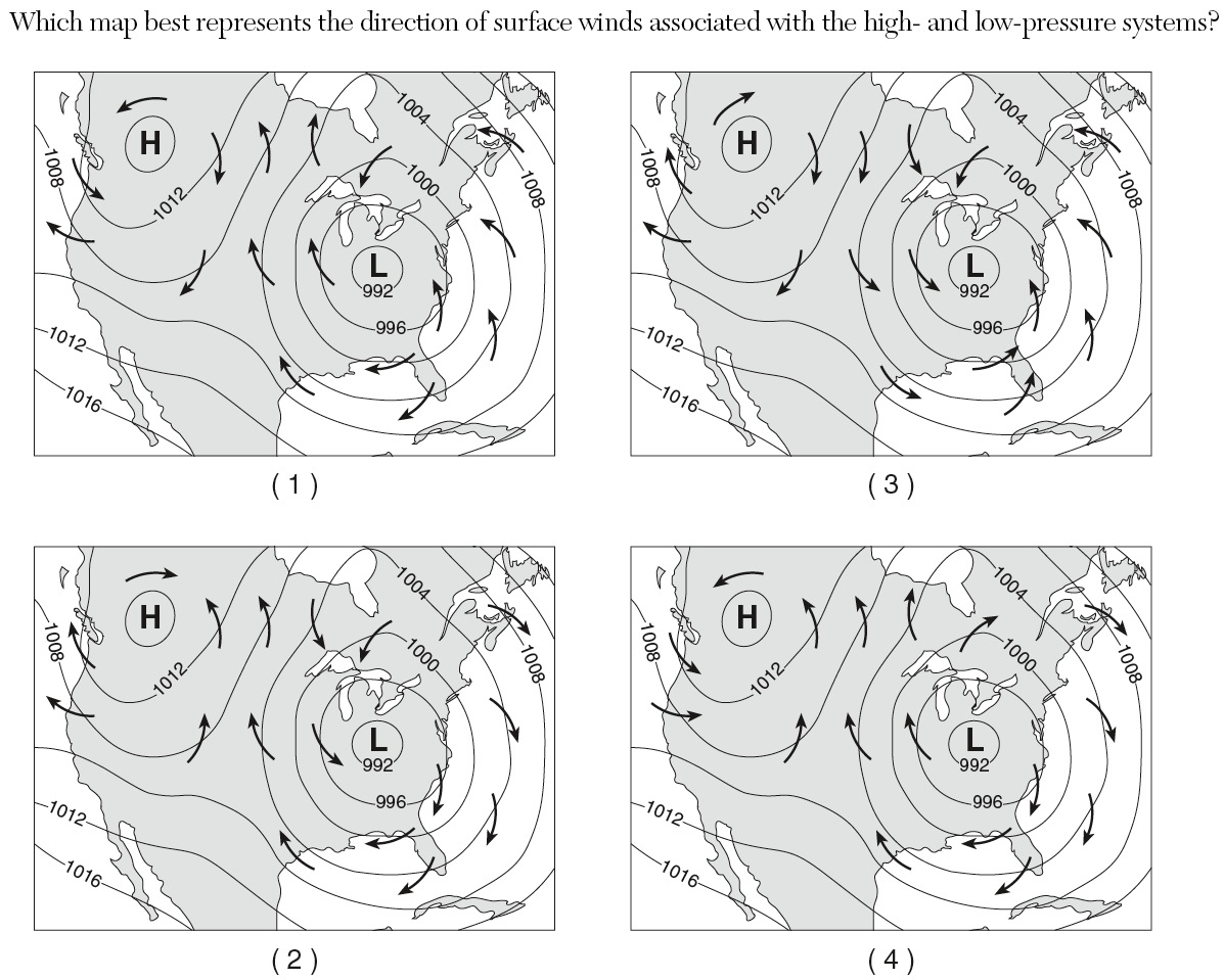
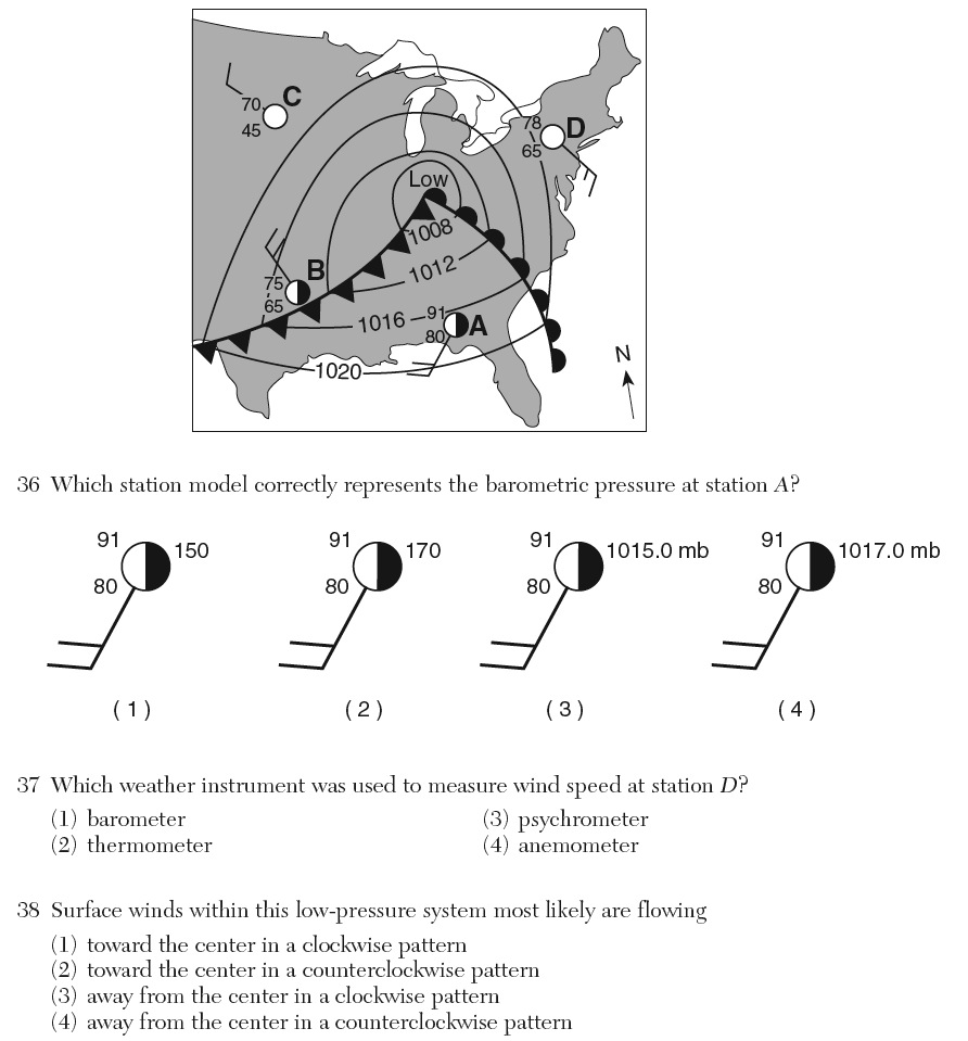
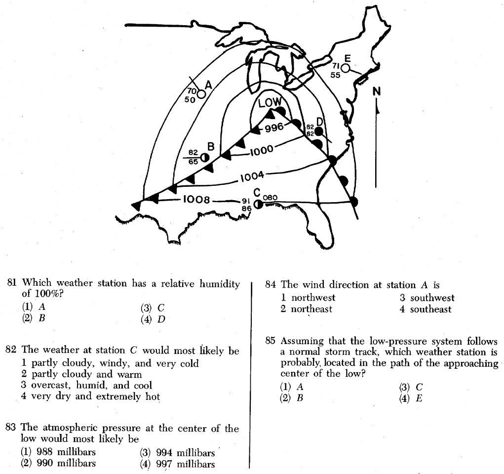
«4. Compare and contrast movement of air in regions of high and low pressure.
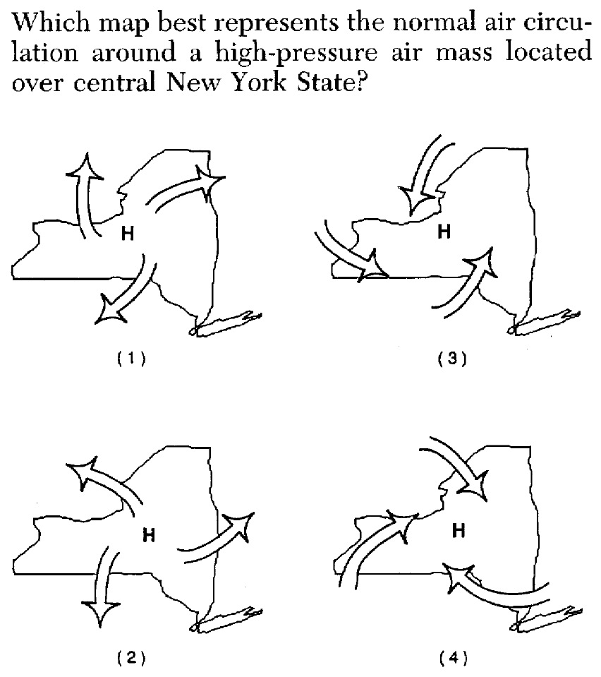
a. pressure: cool, sinking air, diverging (moving away from the center) at Earth’s surface, rotating clockwise north of the equator.
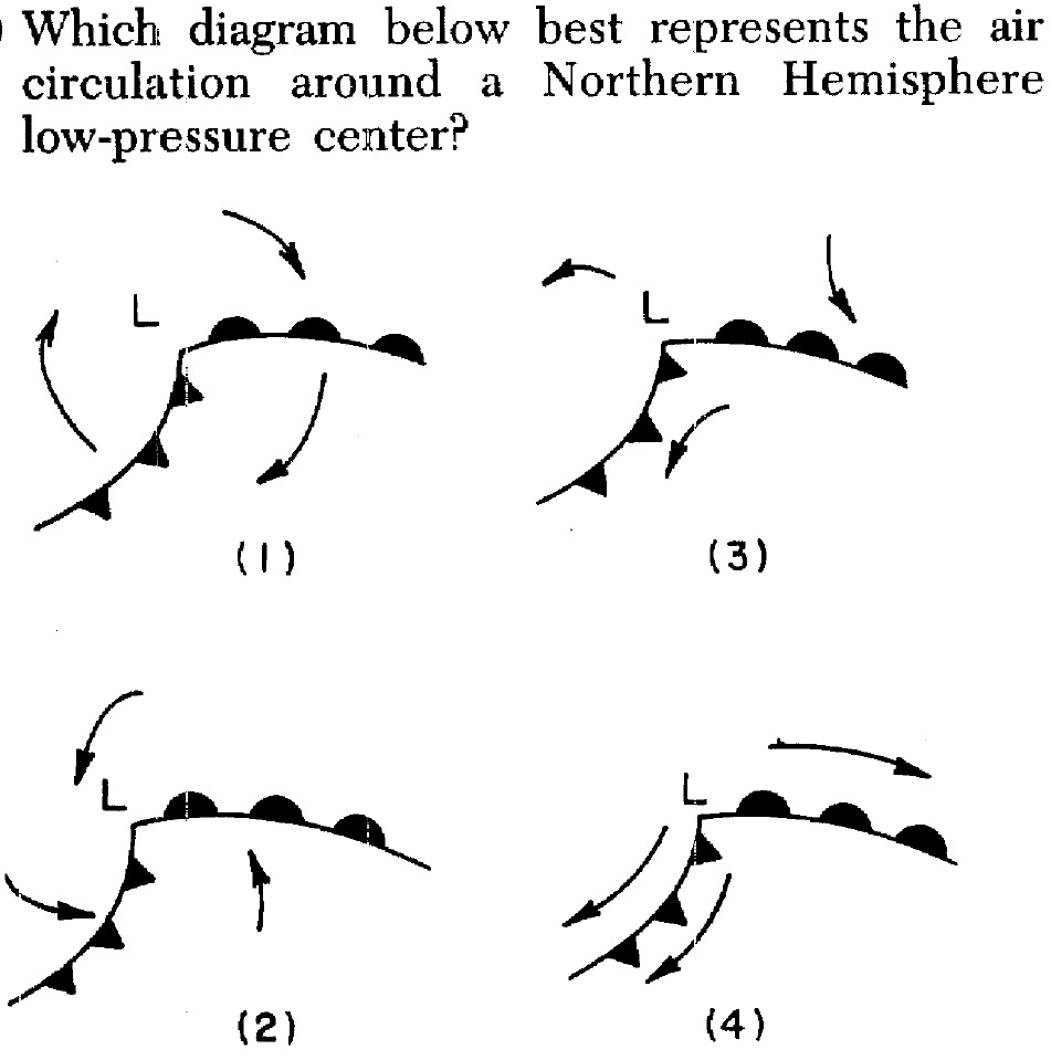
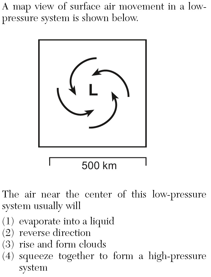
b. pressure: warm, rising air, converging (moving towards the center) at Earth’s surface, rotating counterclockwise.
SLIDES (Q1) (Q2) (Q3) (Q4) (Q5) (Q6) (Q7) (Q8) (Q9) (Q10) (Q11) (Q12) (Q13) (Q14) (Q15) (Q16) (Q17) (Q18)
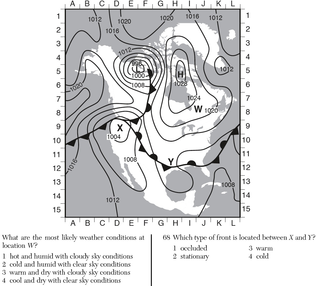
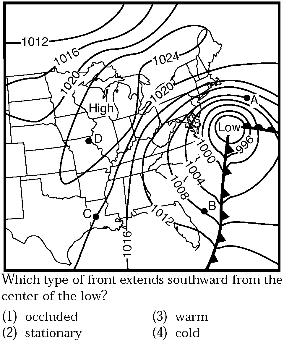
«5. Recognize the patterns of isobars and isotherms.
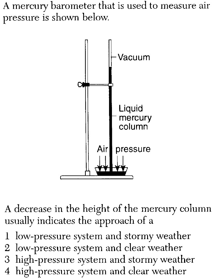
a. Isobar values towards the center of a high. Pressure is at the center of a high.
b. Isobar values towards the center of a low. Pressure is at the center of a low.
c. Isotherms generally in value towards lower latitudes. Earth is warmest near the .
d. Isotherms generally in value towards higher latitudes. Earth is coldest near the .
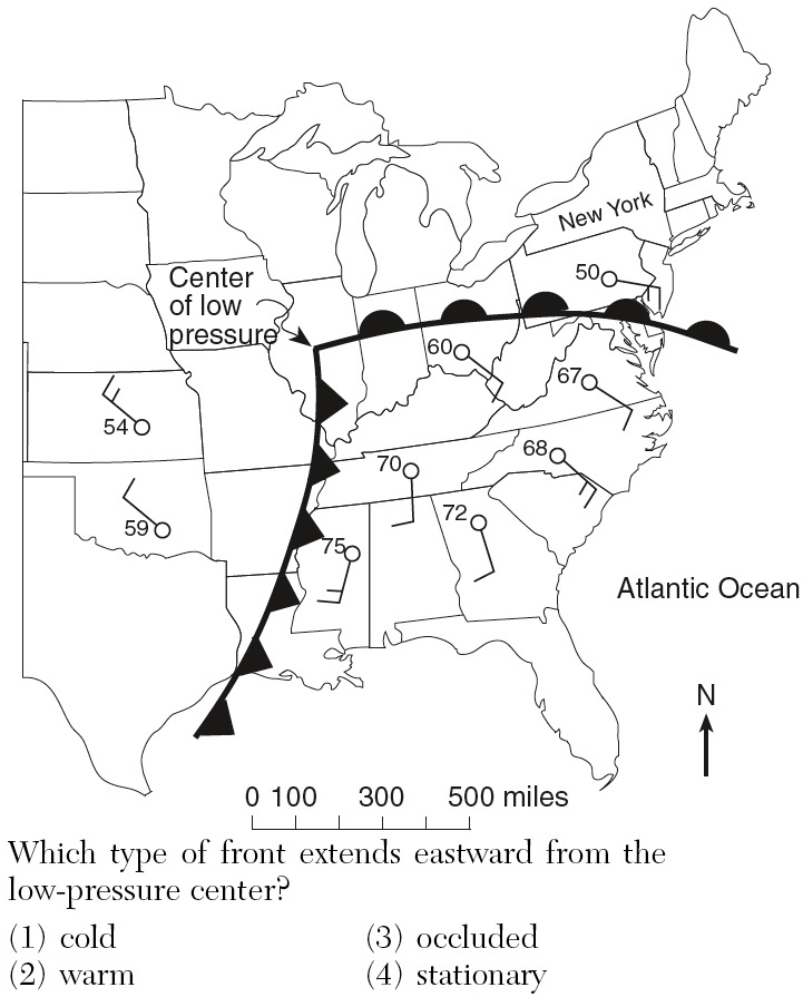
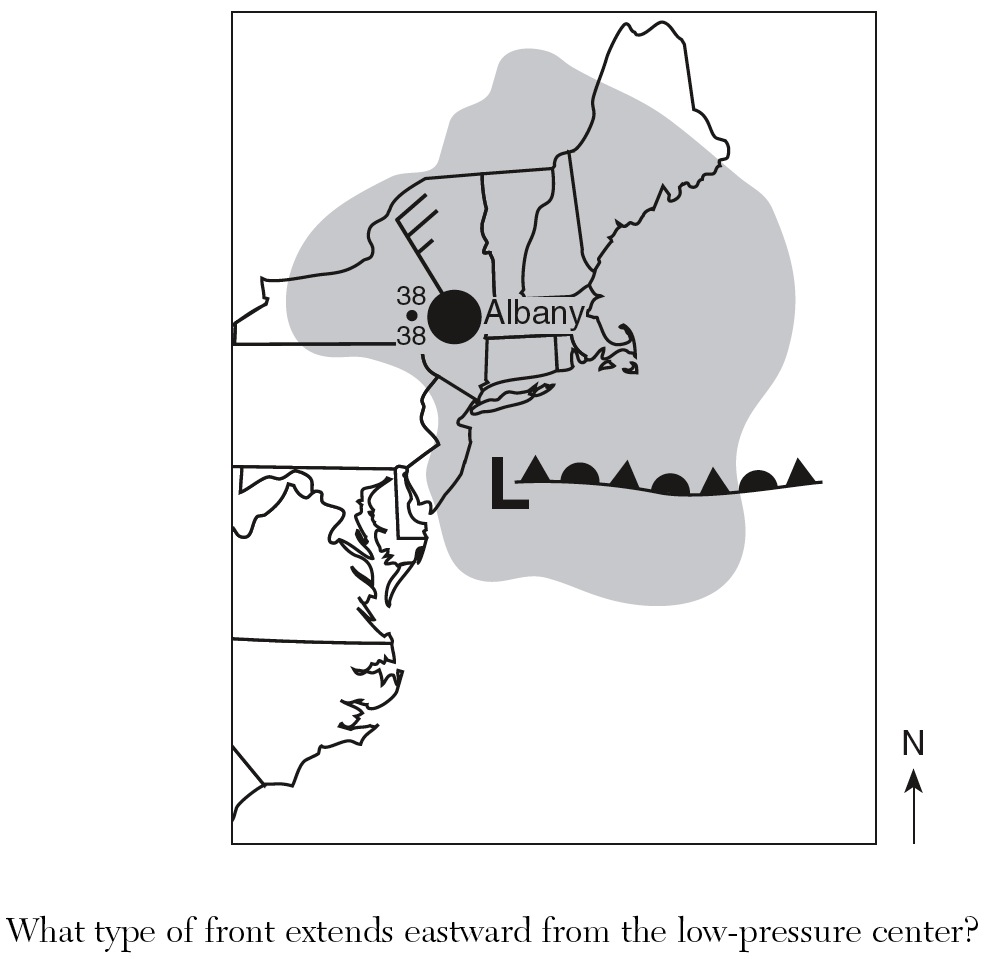
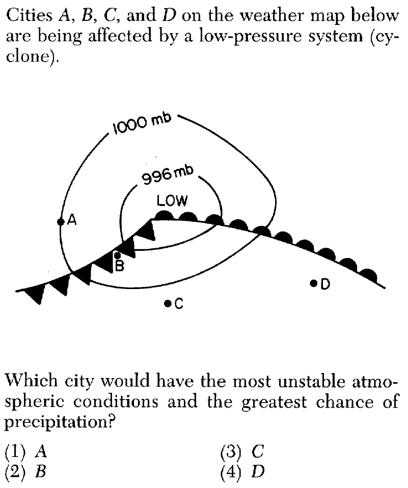
«6. Describe the arrangement of fronts and air masses in a typical low pressure
system.
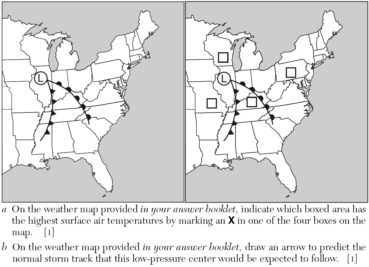
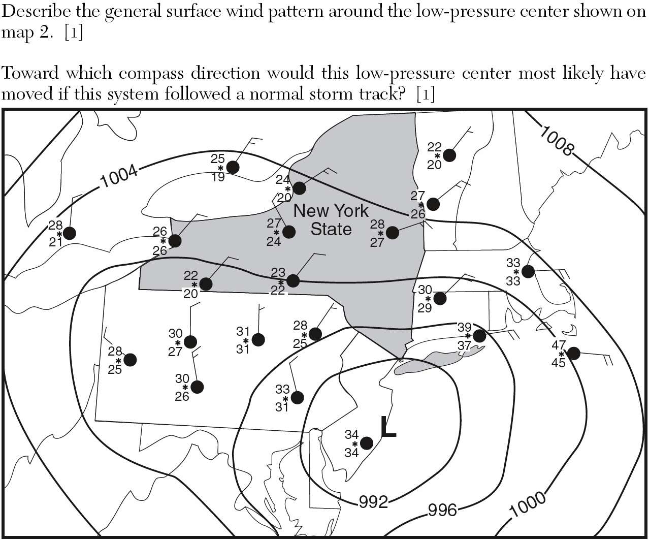
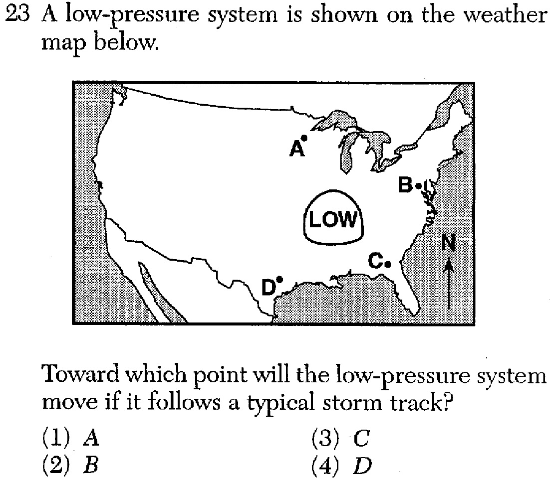
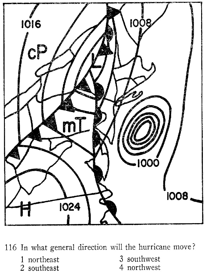
a. The primary weather producers in the middle latitudes are large centers of low that generally travel from west to , called middle-latitude .
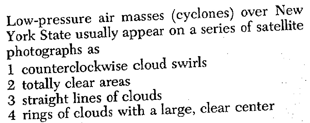
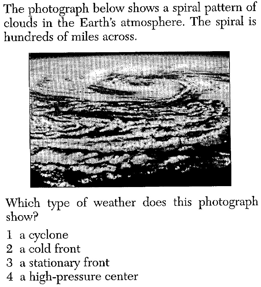
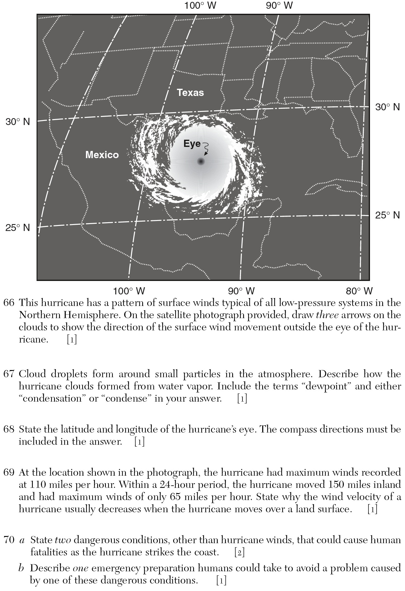
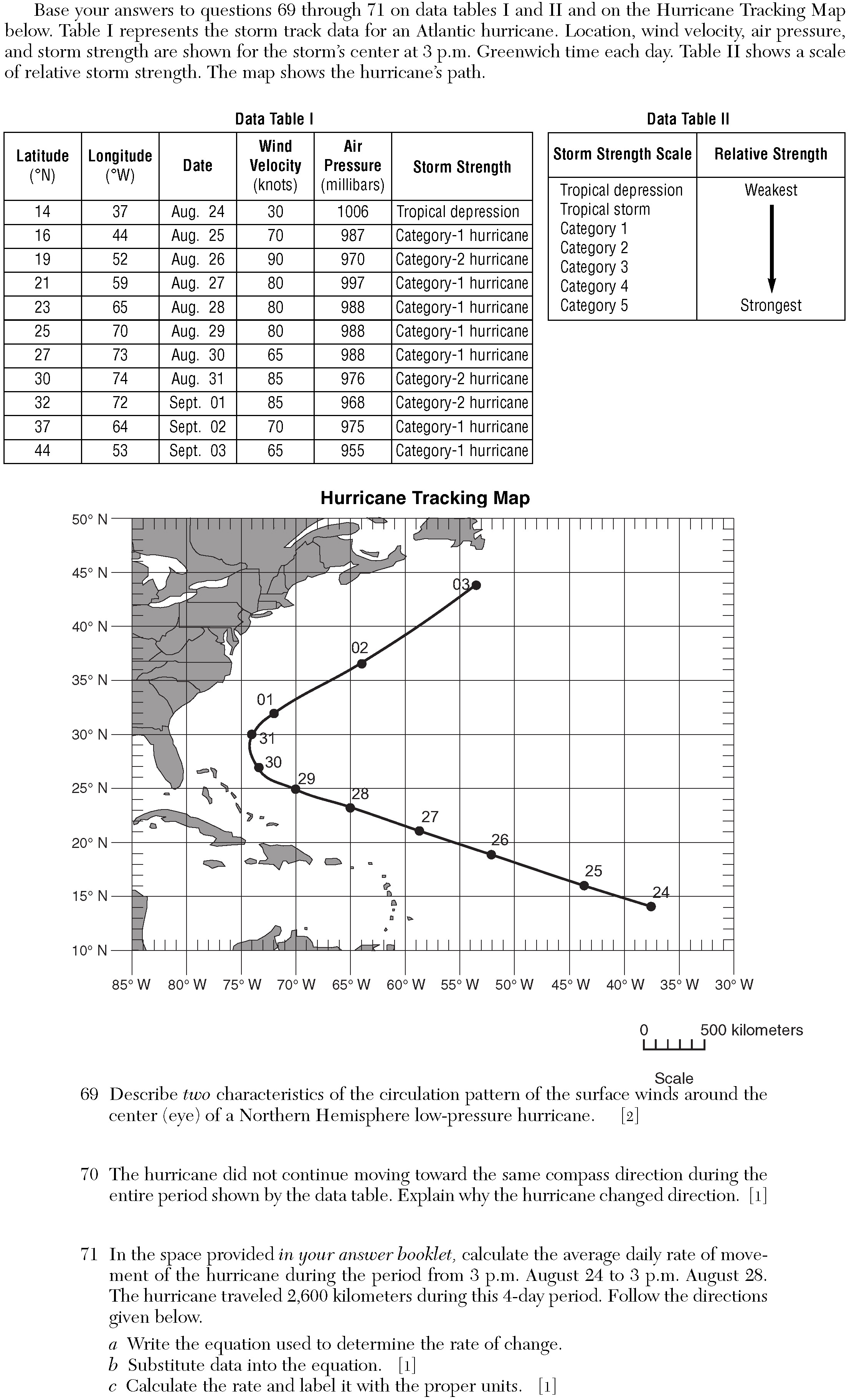
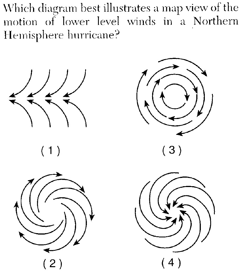
b. These bearers of stormy weather, which last from a few days to a week, have a counterclockwise circulation pattern in the Hemisphere, with an inward flow of air toward their centers.
c. Most middle-latitude cyclones have a cold front extending to the and a warm front extending to the from the central area of low pressure.
d. As the cold front catches up with the warm front, an front forms.
e. A typical low pressure system has a air mass moving eastward towards a warm air mass. The warm air mass typically moves northward towards a cooler air mass. The warm air mass gets pinched between the cold and air masses, and is forced aloft.
«7. Predict future weather for any location within a mid-latitude cyclone.
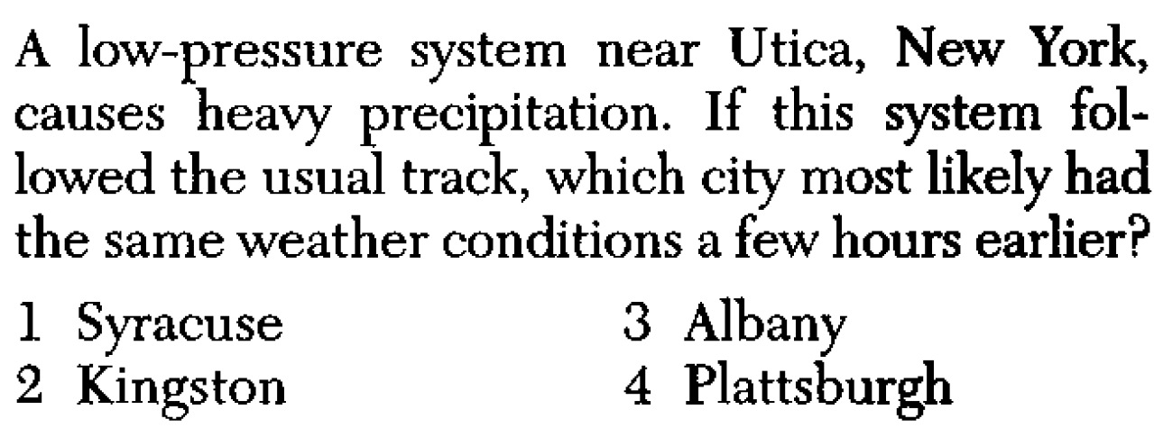
a. Since most mid-latitude cyclones move from to , locations east of the cyclone will usually experience stormy weather in the future.
b. As the different approach an area, the weather will change accordingly (see 4a-f).
c. Locations near the experience the stormiest weather.
d. Weather become apparent when weather variables are observed, measured, and recorded. These variables include air temperature, air pressure, moisture (relative humidity and dewpoint), precipitation (rain, snow, hail, sleet, etc.), wind speed and direction, and cloud cover.
e. Atmospheric moisture, temperature and pressure distributions; jet streams, wind; air masses and frontal boundaries; and the movement of cyclonic systems and associated tornadoes, thunderstorms, and hurricanes occur in observable .
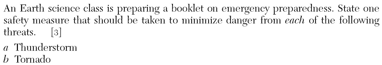
f. Loss of property, personal injury, and loss of can be reduced by effective emergency preparedness.
SLIDES (Q1) (Q2) (Q3) (Q4) (Q5) (Q6) (Q7) (Q8) (Q9) (Q10) (Q11) (Q12) (Q13) (Q14) (Q15) (Q16) (Q17) (Q18) (Q19) (Q20) (Q21) (Q22) (Q23) (Q24) (Q25) (Q26) (Q27) (Q28)
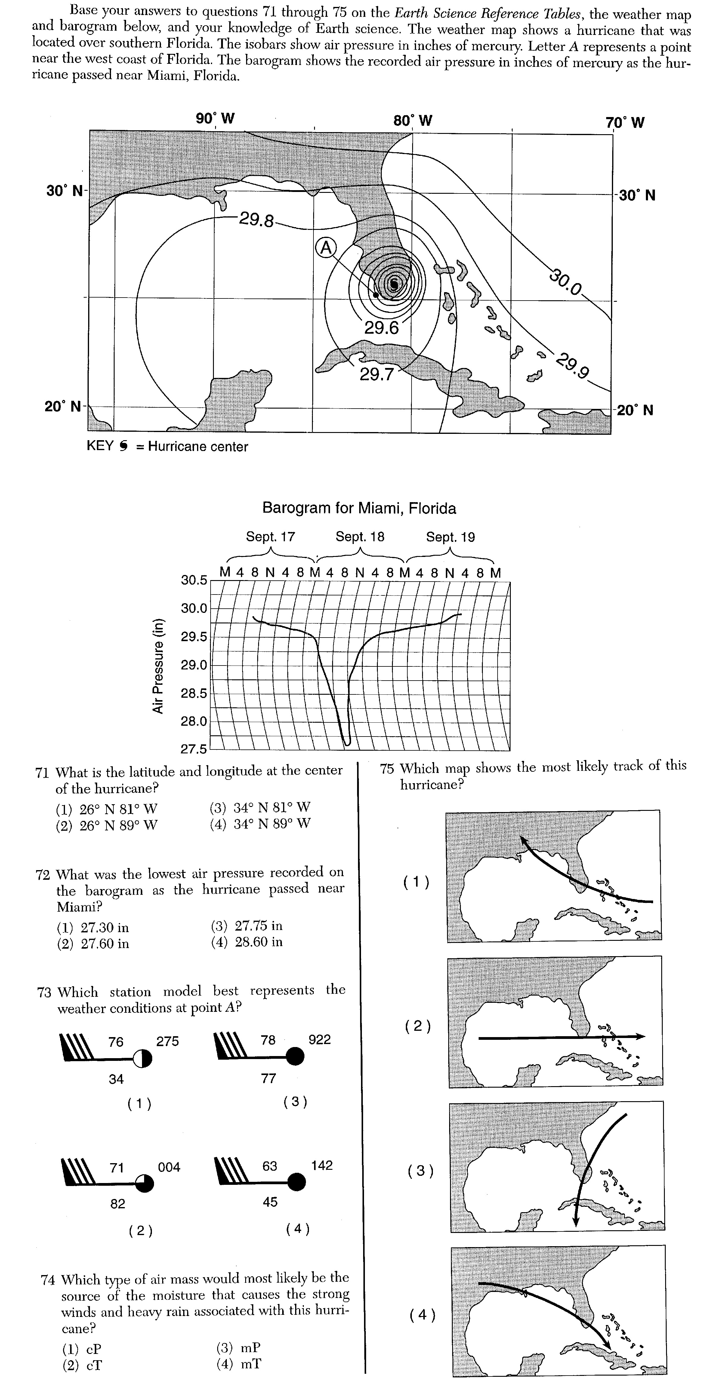
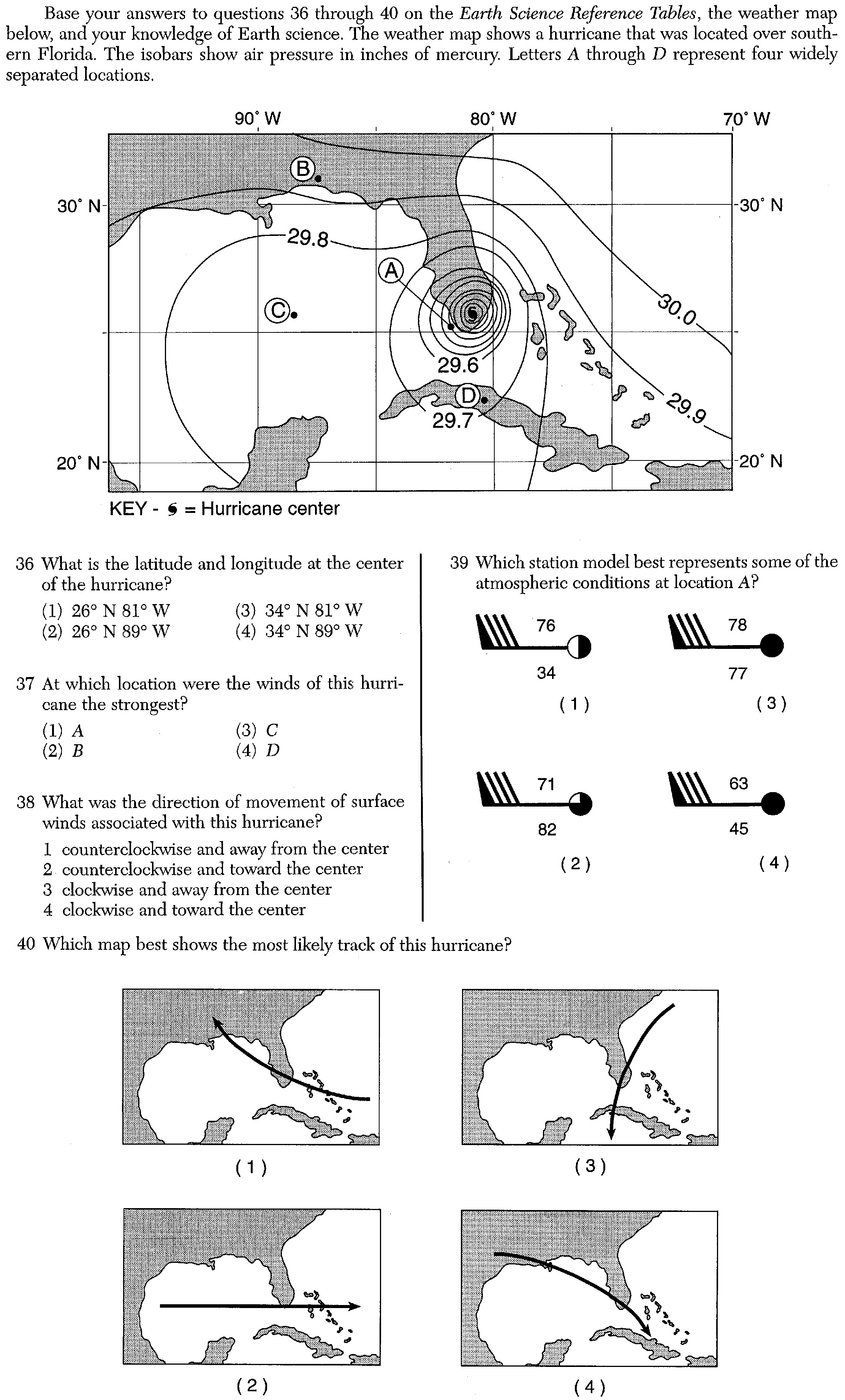
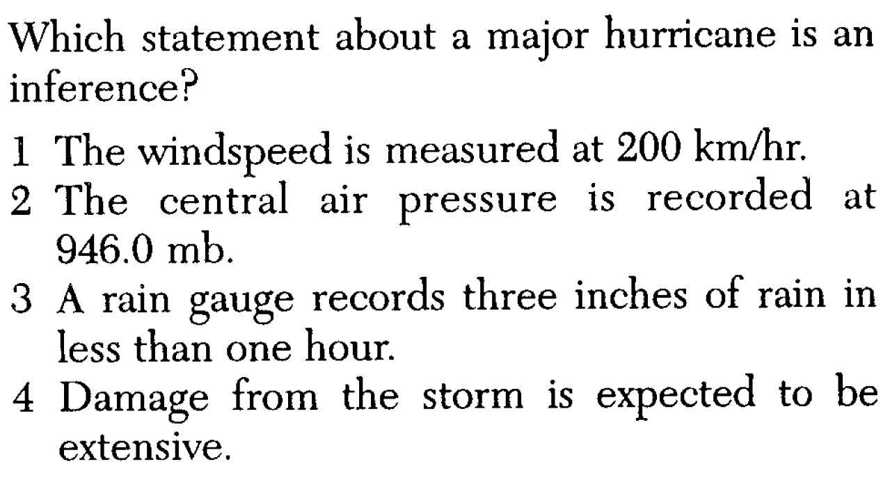
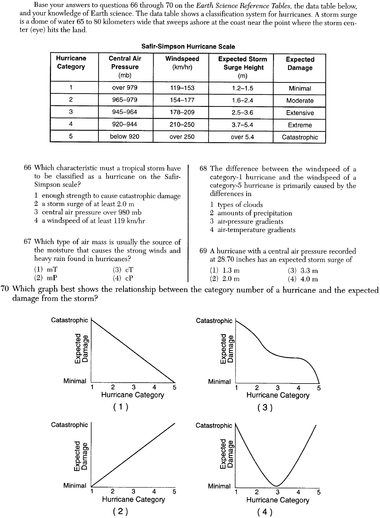
«8. Describe hurricanes.
a. , the greatest storms on Earth, are tropical cyclones with wind speeds in excess of 119 kilometers (74 miles) per hour.
b. They have diameters of 250 to 500 miles, and a calm central “ ” where air is sinking.
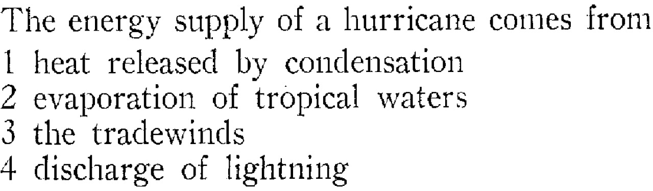
c. These complex tropical disturbances develop over tropical ocean waters and are fueled by the released when huge quantities of water vapor condense.
d. Hurricanes form most often in late when ocean-surface temperatures reach 27°C (80°F) or higher and thus are able to provide the necessary heat and moisture to the air.
e. Hurricanes diminish in intensity whenever they move over ocean water that cannot supply adequate heat and moisture, or move onto .
f. Hurricanes usually cause the most damage where they first move over .
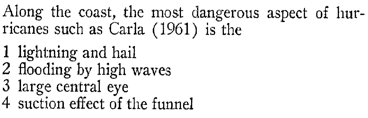
g. Hurricane damage is of three types: 1) (the dome of water that builds up as a hurricane moves over water. As this water comes ashore with the storm, it causes flooding that is usually a hurricane's biggest killer), 2) wind damage, and 3) inland flooding.
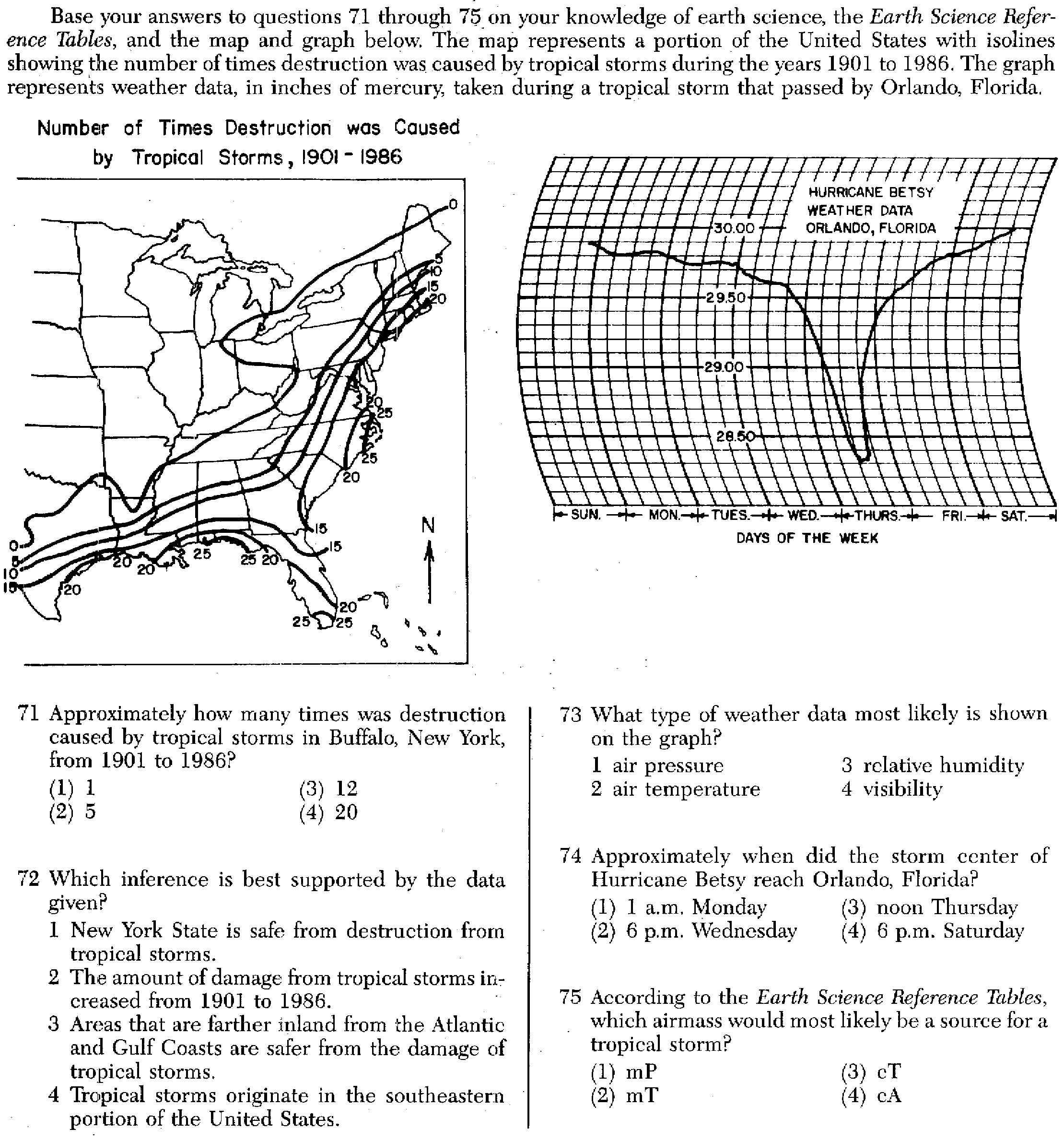
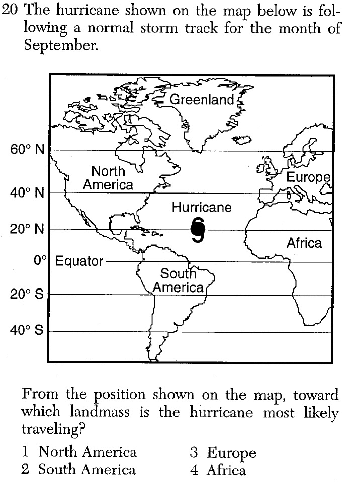
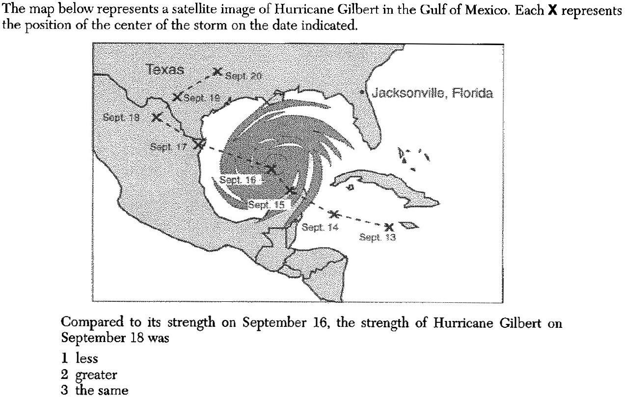
«9. Understand storm tracks of hurricanes.
a. The hurricanes that affect us originate in the eastern tropical Atlantic Ocean near the shores of .
b. They are driven towards the Caribbean Islands, south of America, by easterly winds in the tropics.
c. Eventually, these storms turn northwestward and migrate into higher .
d. As a result, the Gulf of and Coast of the United States are at risk to experience one or more hurricanes each year.
SLIDES (Q1) (Q2) (Q3) (Q4) (Q5) (Q6) (Q7) (Q8) (Q9) (Q10) (Q11) (Q12) (Q13) (Q14) (Q15) (Q16) (Q17) (Q18) (Q19)
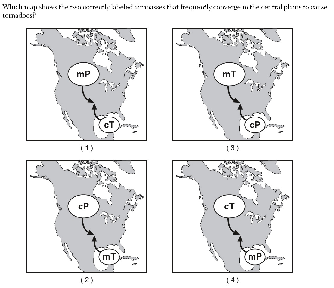
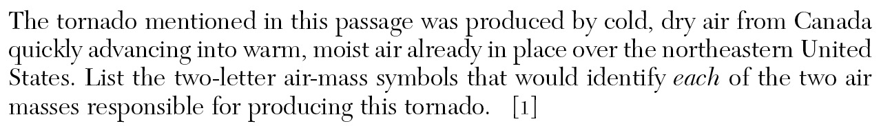
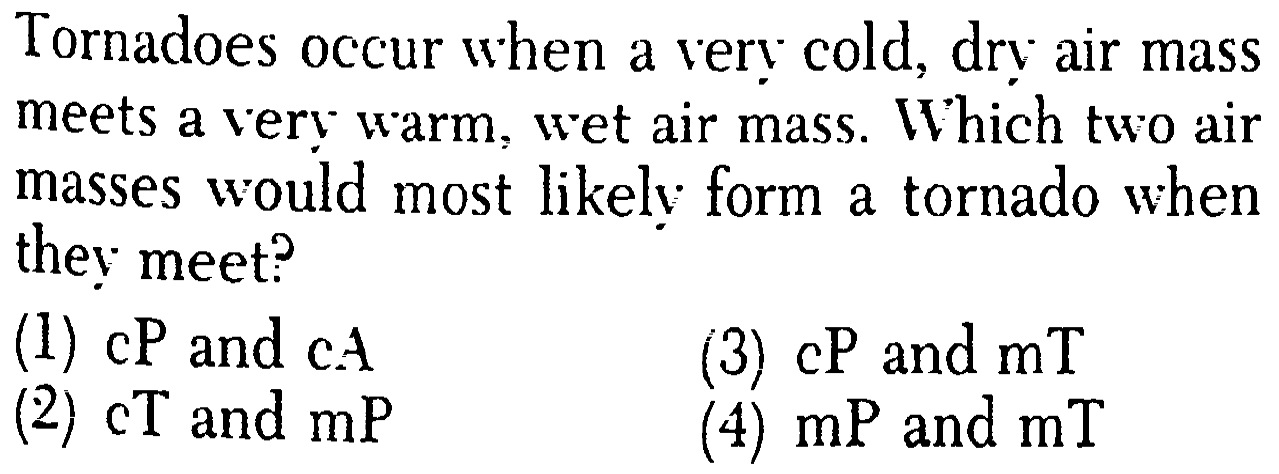
«10. Describe tornadoes.
a. , destructive, local storms of short duration, are violent windstorms associated with severe thunderstorms that take the form of a rotating funnel of air that extends downward from a storm cloud.
b. Tornadoes most often occur during the months.
c. They are most frequent in the United States, in the area between the Rockies and the Appalachians. Cold Canadian air moves , and meets warm Gulf air moving . The warm air is forced to very rapidly, causing tornadoes.
d. is commonly produced by tornadoes.
SLIDES (Q1) (Q2) (Q3) (Q4) (Q5) (Q6) (Q7) (Q8) (Q9) (Q10) (Q11)